Machu Picchu
Agenda
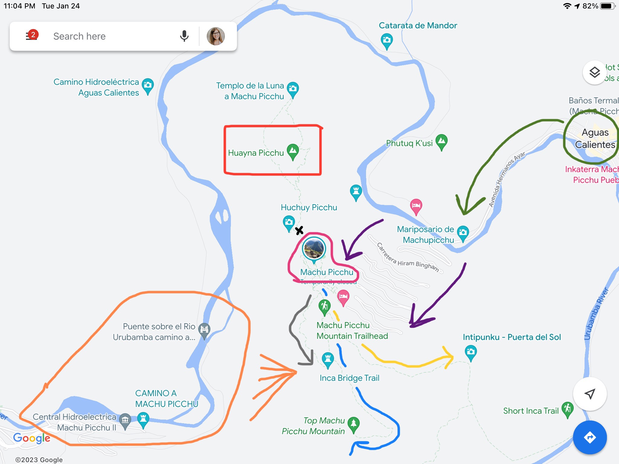
The map to the right with the list below shows our movement to various notable landmarks at Machu Picchu.
1) Green: Aguascalientes.
2) Purple: Hiram Bingham Highway.
3) Red: Huayna Picchu
4) Blue: Machu Picchu Mountain
5) Yellow: Intipunku / Sun Gate
6) Gray: Inka Bridge
7) Orange: Urubamba Valley
8) Black X: Sacred Rock
9) House of the Guardian of Funerary Rock
10) Pink: The City
- Sacred Plaza
- House of the High Priest
- Houses / Living Quarters
- Temple of the Sun
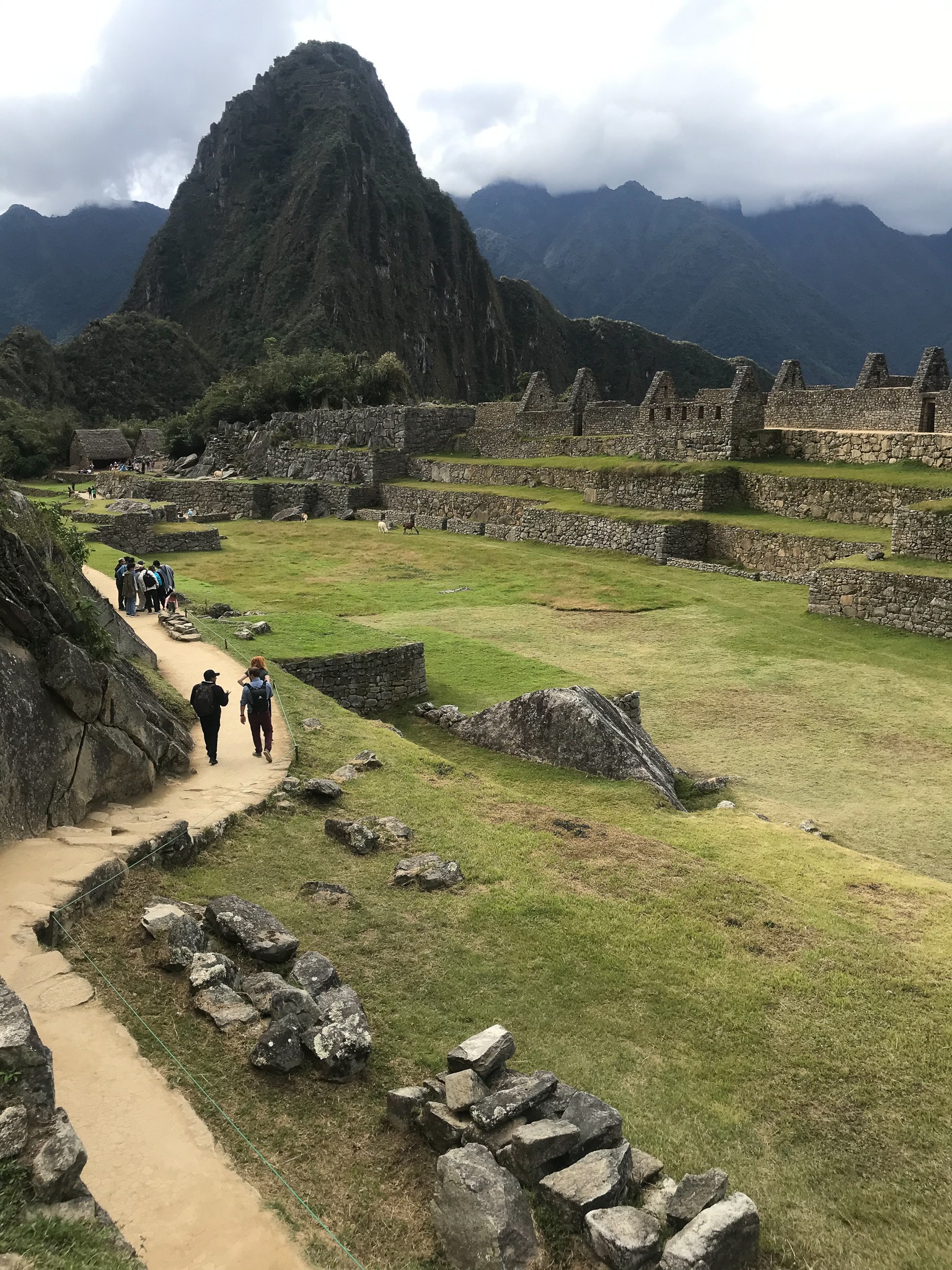
- Terraces
- Central Plaza
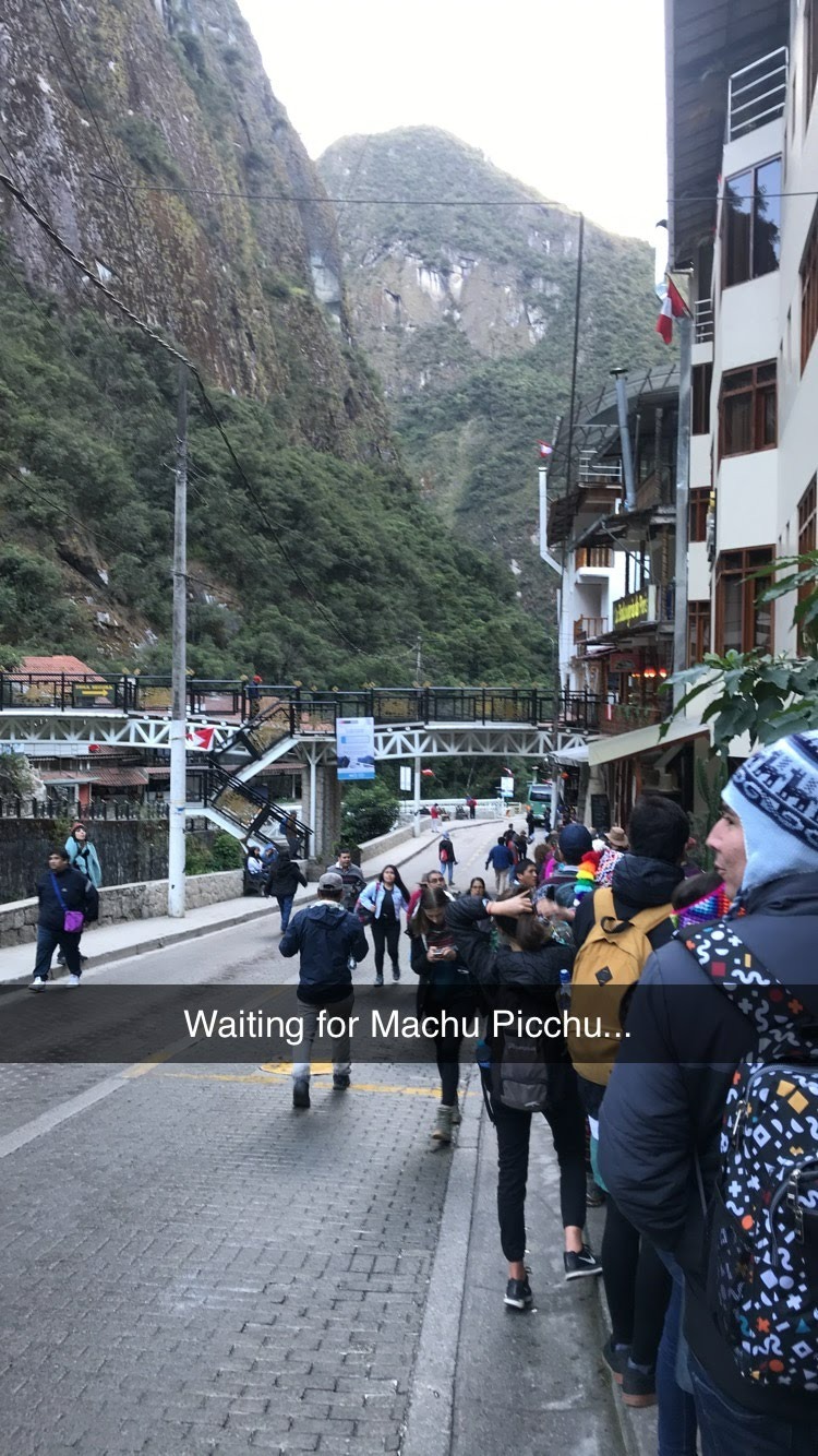
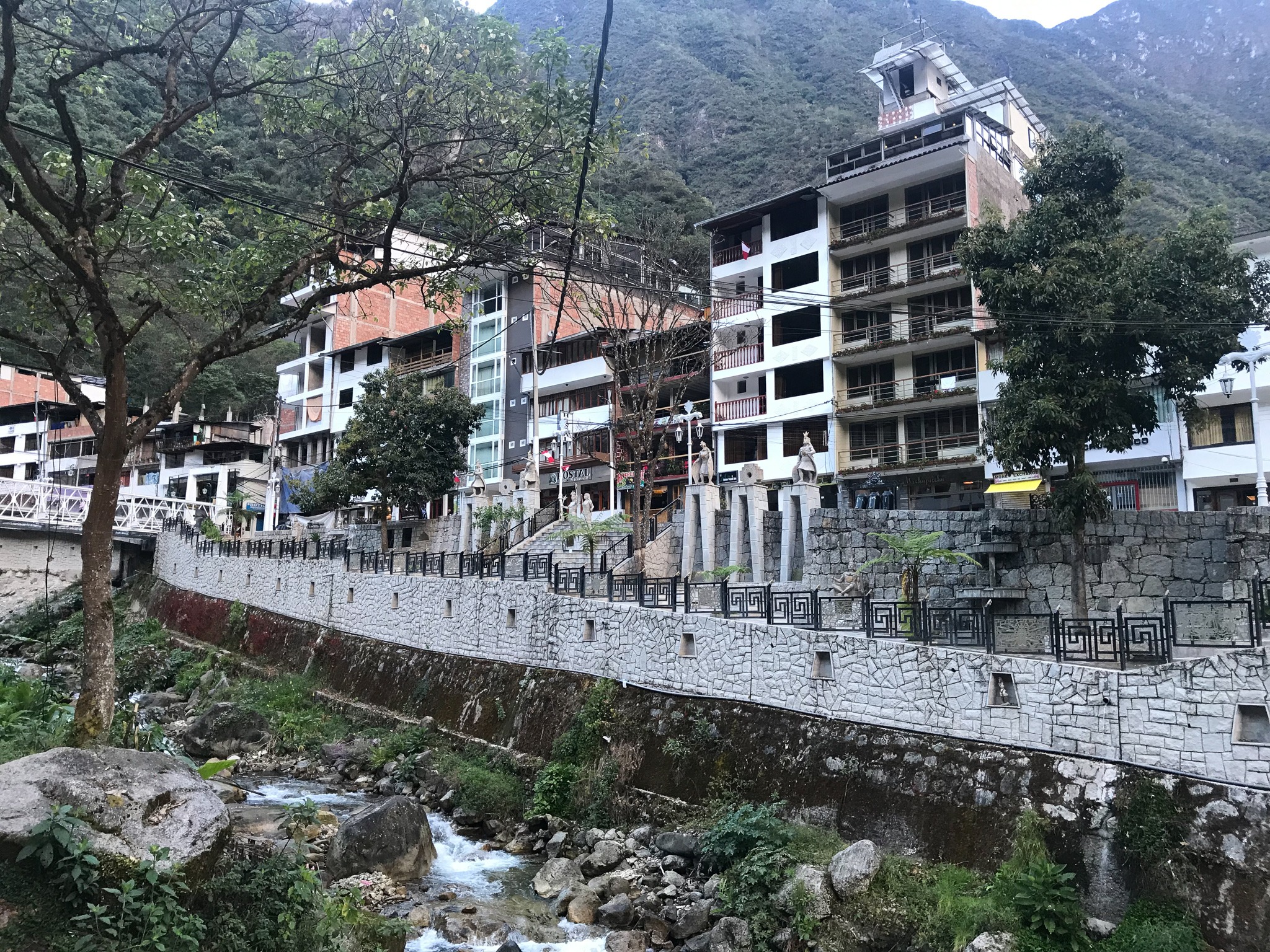
1) Aguas Calientes
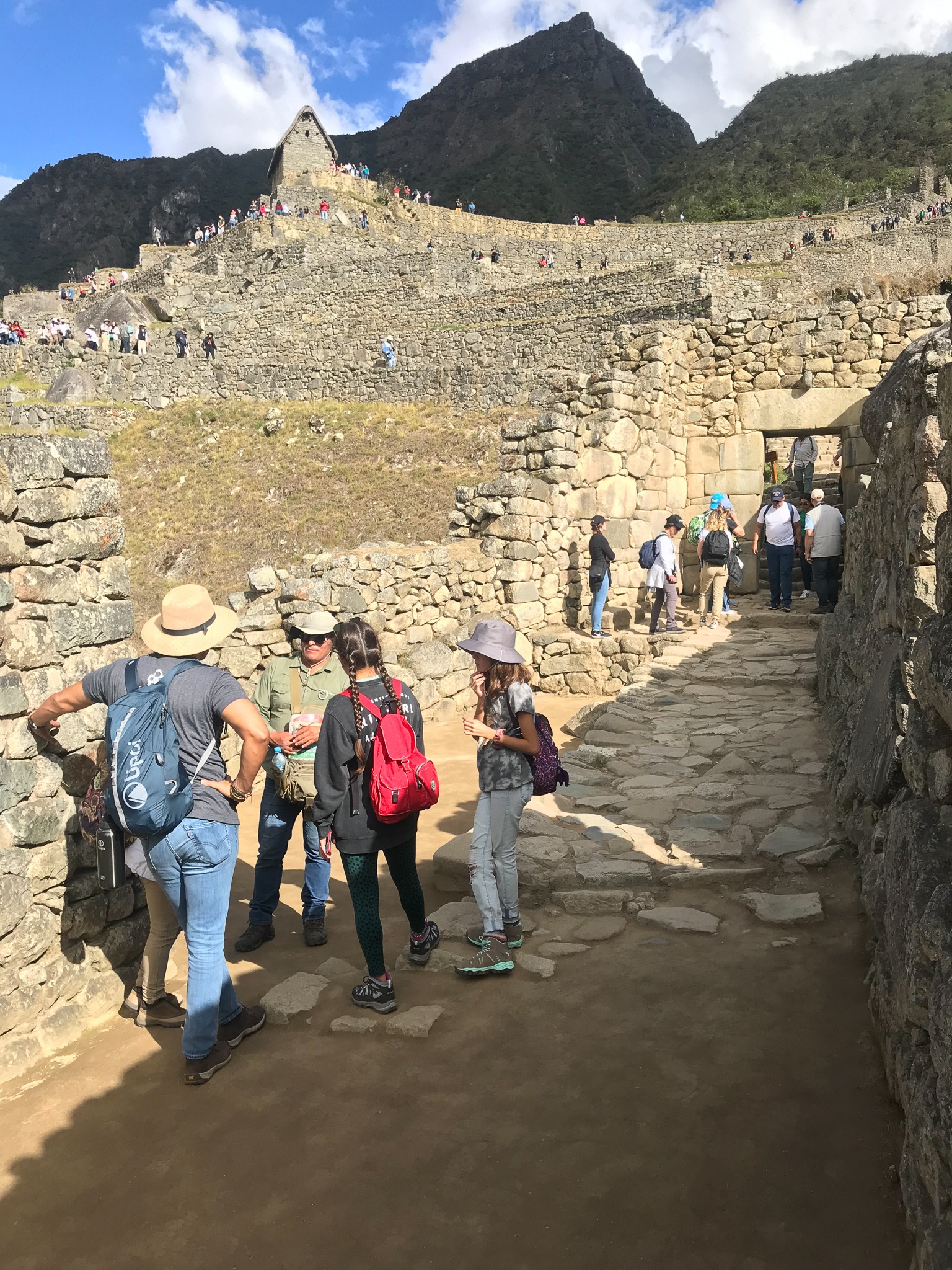
Aguas Calientes, which is also known as Machu Picchu Town, is like "home base" for people visiting and working at Machu Picchu. We slept in a hotel here the night before visiting Machu Picchu. We woke up early in the morning to wait in line for a bus that would take us to the site.
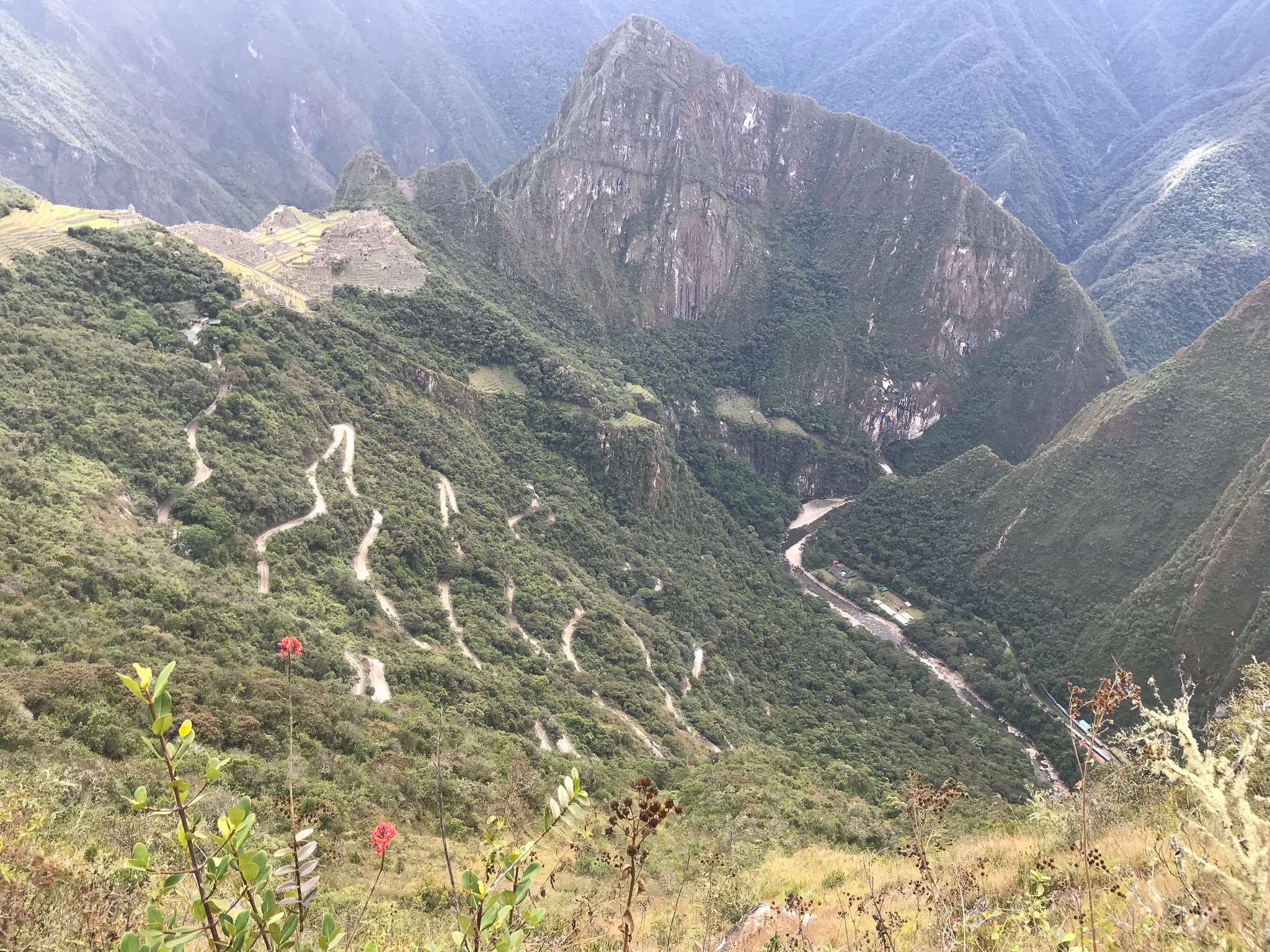
2) Carretera Hiram Bingham
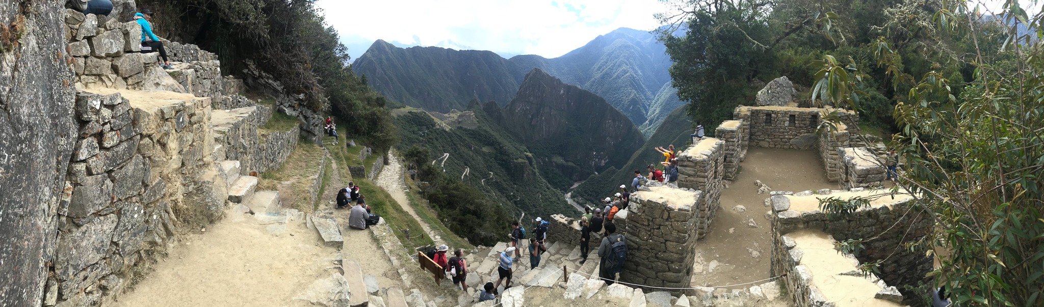
The windy road that you see in the picture below is Hiram Bingham Highway (although it's not really what I think of as a "highway"). This road leads up the hill to the entrance of Machu Picchu. Some people hike it. We took a bus.
Hiram Bingham is the explorer credited with "re-discovering" Machu Picchu. Historians say that Machu Picchu was built by the Inca Empire in the 1400's and occupied until the 1530's, when it was eventually abandoned during the Spanish conquest of Peru. Rumors persisted about the "Lost City of the Incas" over the next few centuries. Hiram Bingham, an explorer, historian, and eventual politician, led an expedition in 1911 that "rediscovered" the site.
(I keep putting "re-discovered" in quotes because I have to feel that this was a "Western discovery" and that Machu Picchu was likely known and never really "lost" to the generations of people native to this region of Peru.)
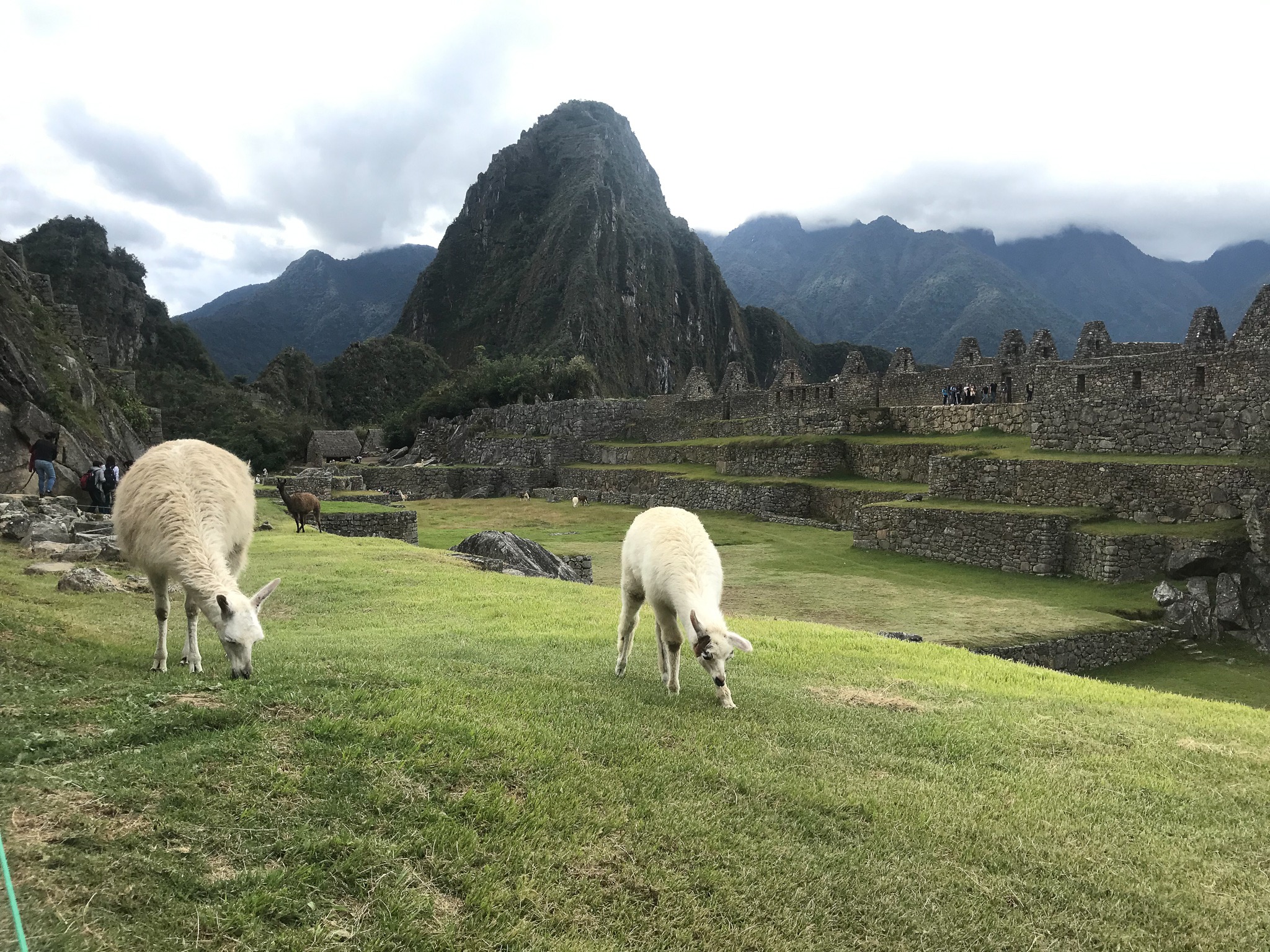
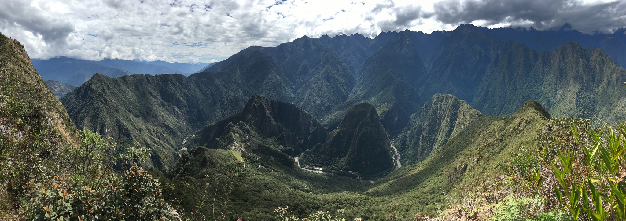
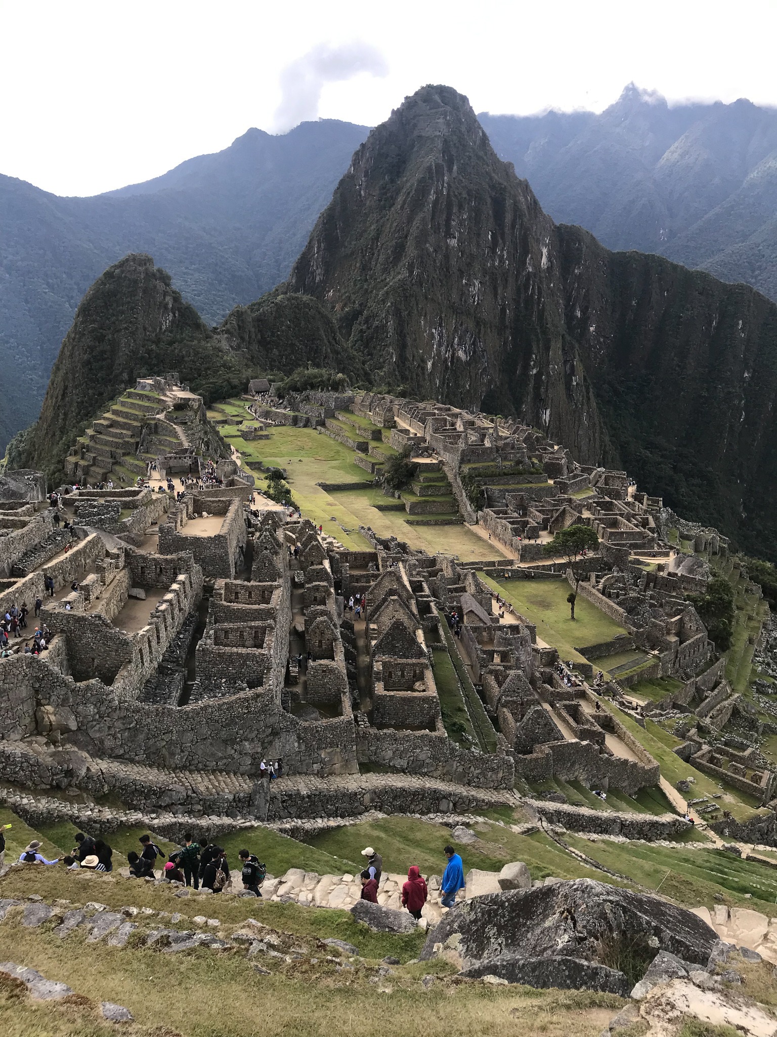
3) Huayna Picchu
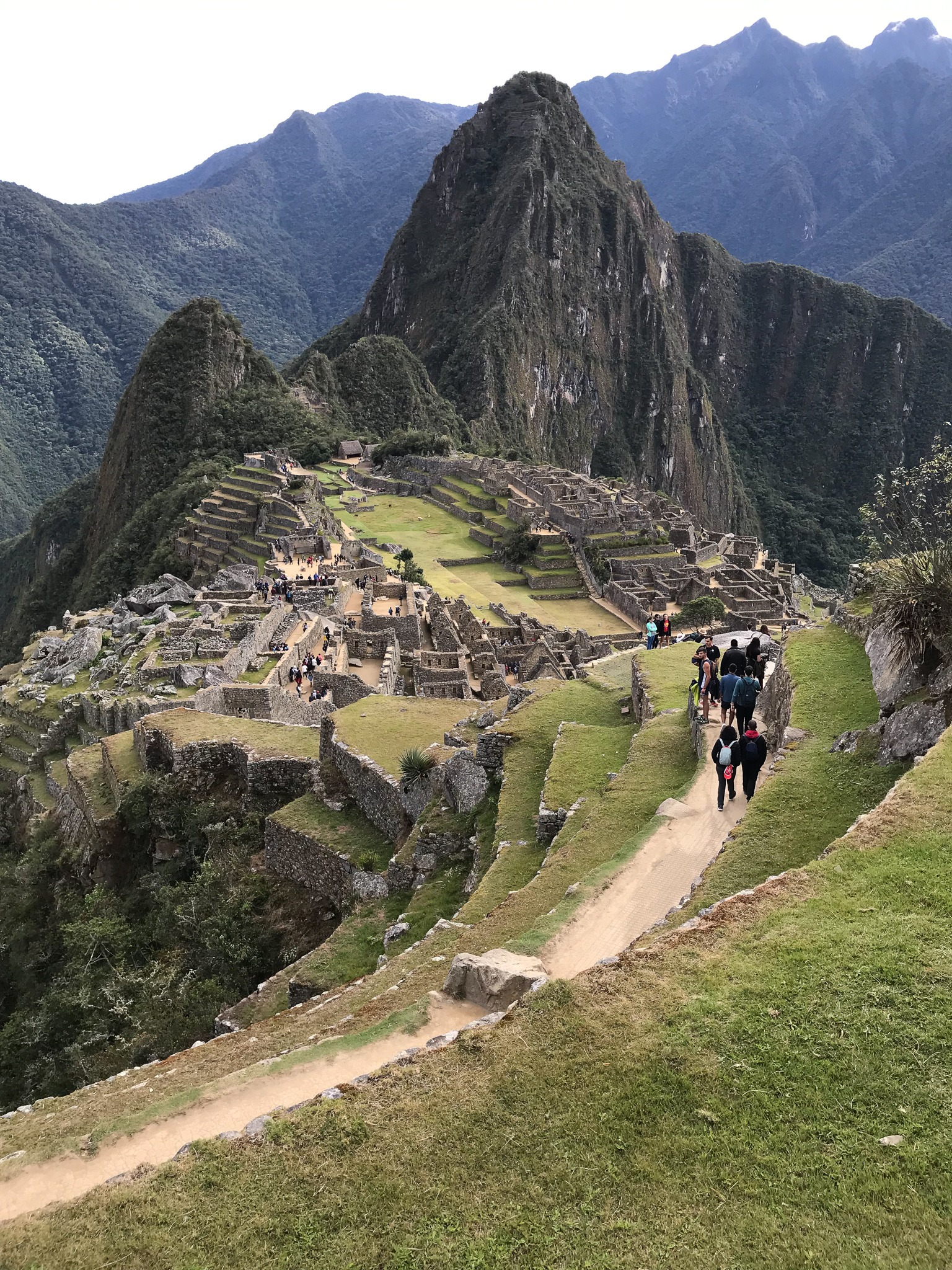
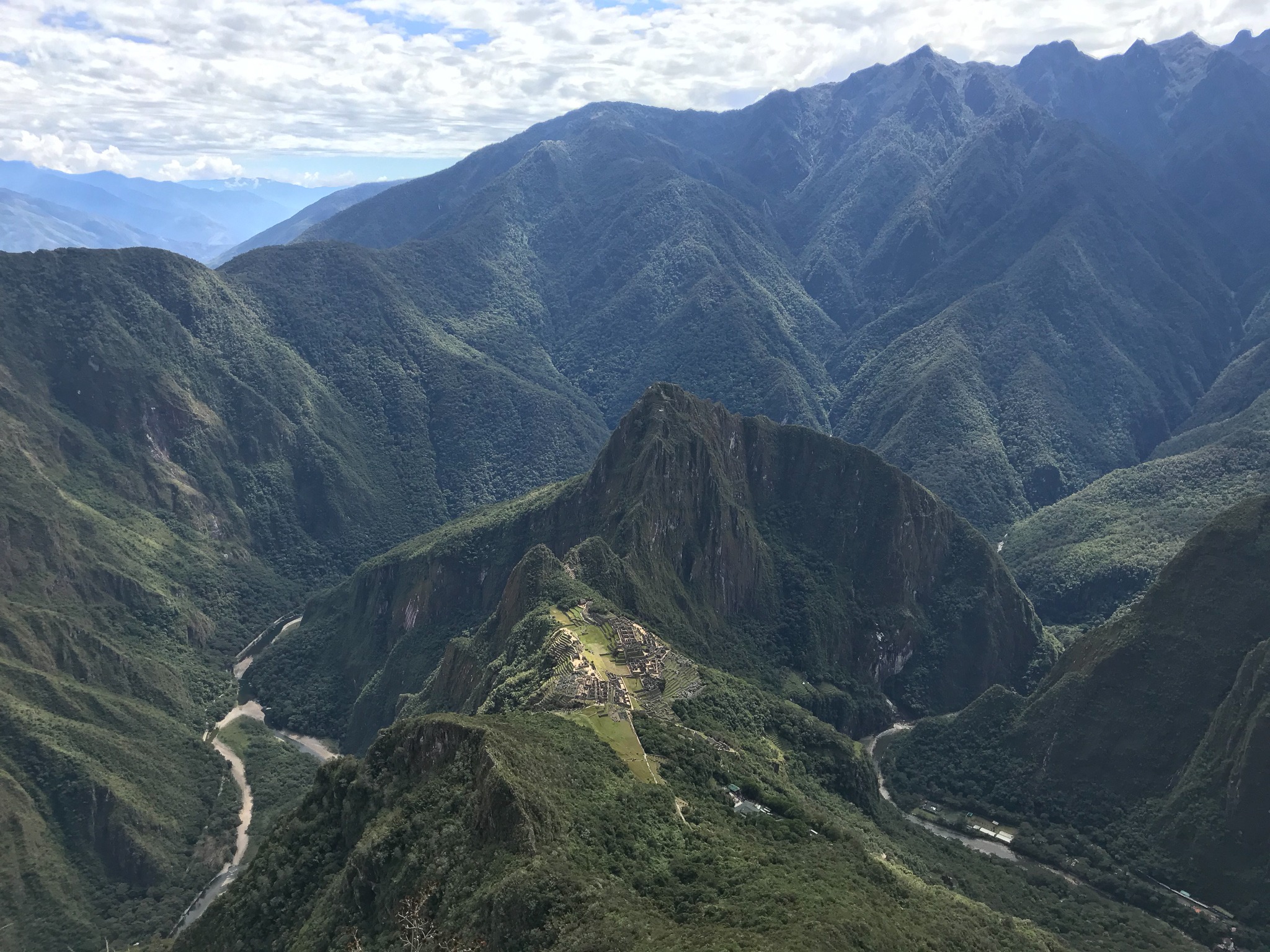
Huayna Picchu is the mountain that you see behind the citadel in so many pictures of Machu Picchu, just like my picture to the left. You can climb it, but they only allow a limited number of climbers each day. Tickets to climb Huayna Picchu sell out months in advance. Unfortunately, I didn't plan this trip far enough in advance to get tickets to climb it.
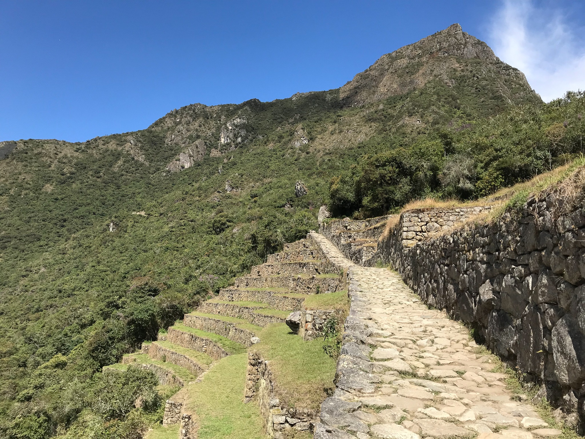
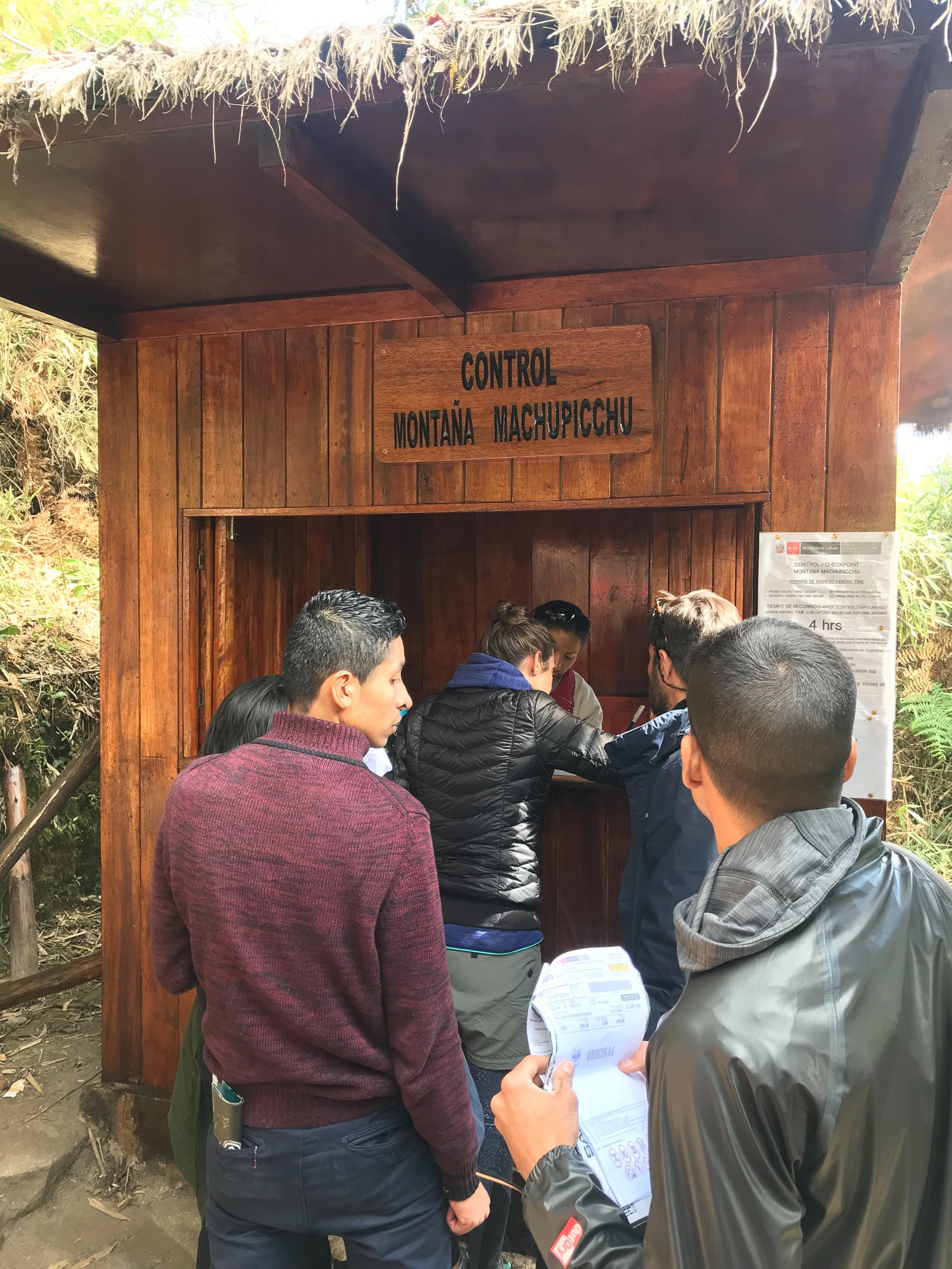
4) Montaña Machu Picchu
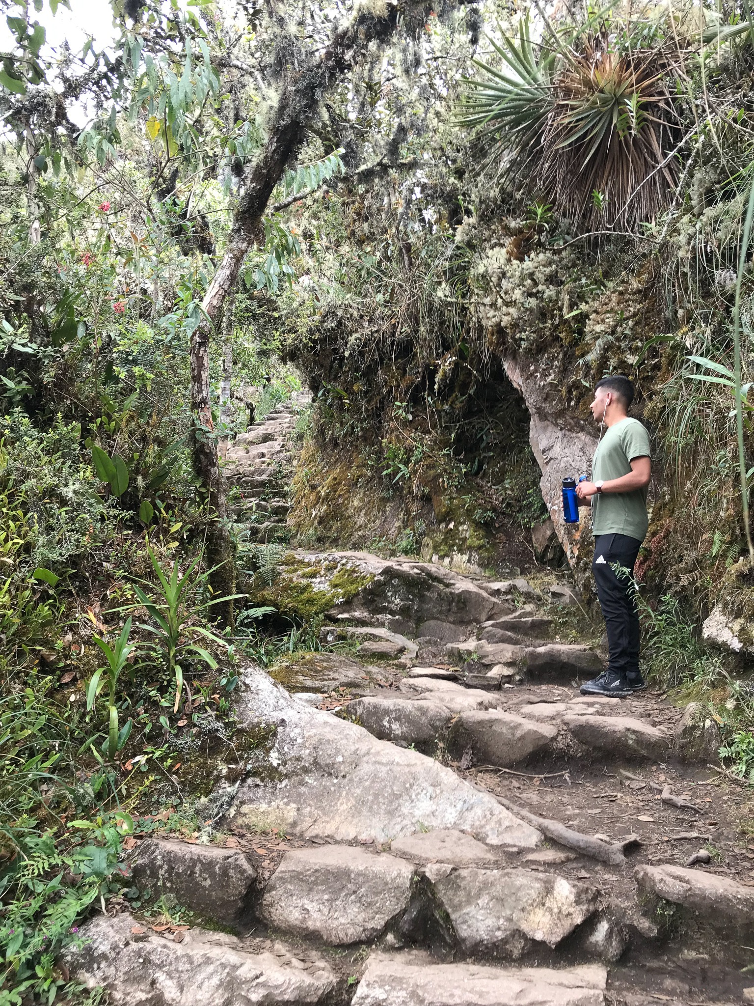
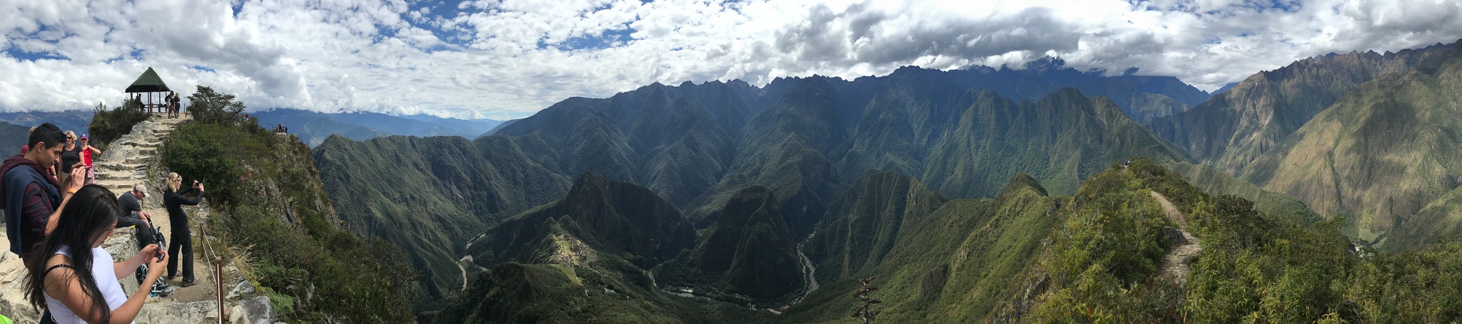
Do you see the peak in the top, right corner of the picture to the left below? This is the top of Machu Picchu Mountain. It's much easier to get tickets to climb to the top of this mountain, so we did.
Machu Picchu citadel is at an elevation of 7,972 feet above sea level (2,430 meters). The peak of Machu Picchu Mountain is 10,111 feet above sea level (3,082 meters), so another 2,139 feet (652 meters) higher. The climb to the top took us about 90 minutes.
5) Intipunku
Next, we hiked to the Sun Gate, or Puerta del Sol in Spanish, or Intipunku in Quechua. The Sun Gate is believed to have been a control port for people entering and exiting the city, as it lies here on the final path of the famous Inca trail, about only a 40-minute walk to the city. The Sun Gate has its name because it is dedicated to the sun. The sun's rays shine on the fortress through the Sun Gate on the Summer Solstice each year.
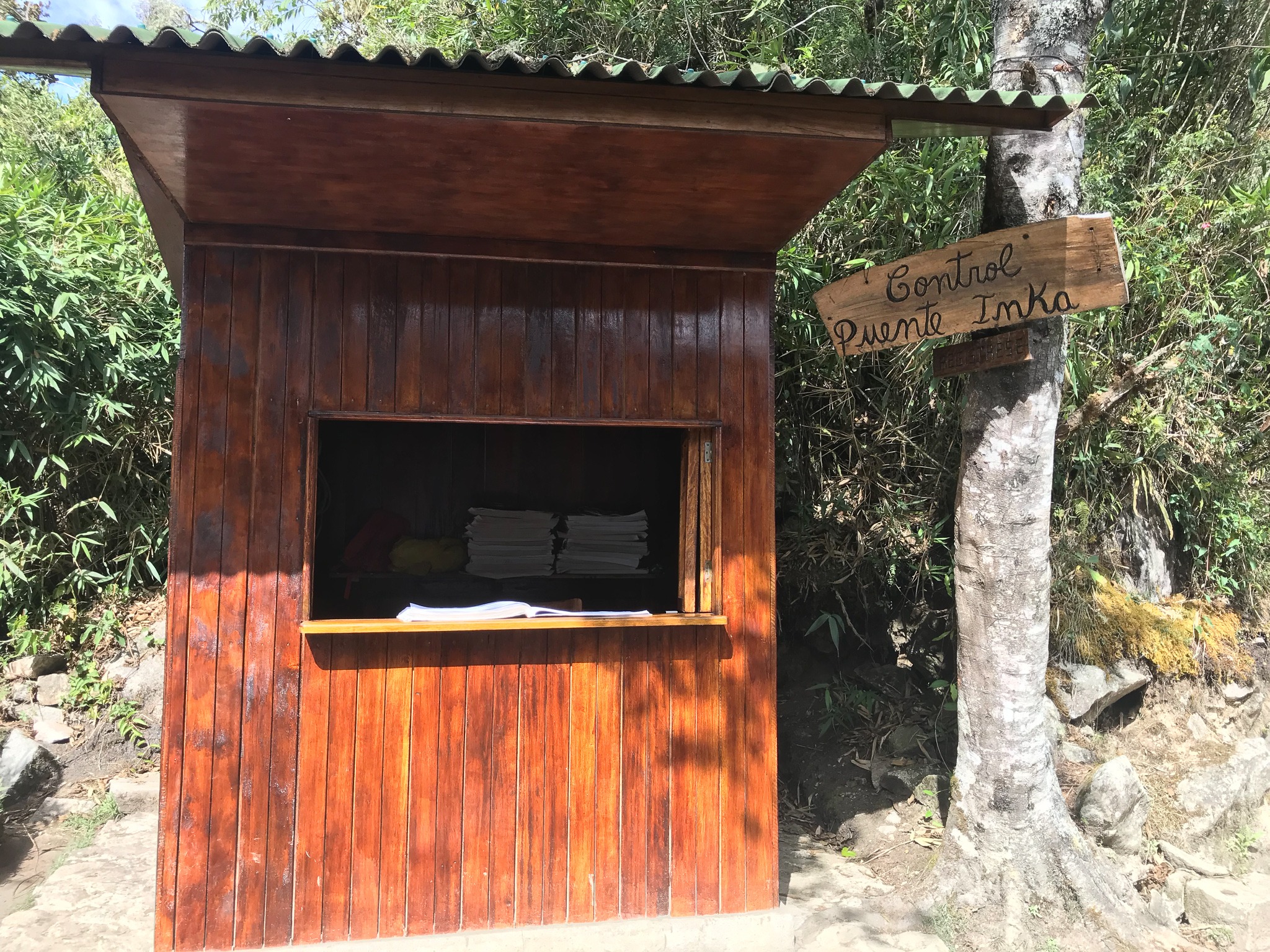
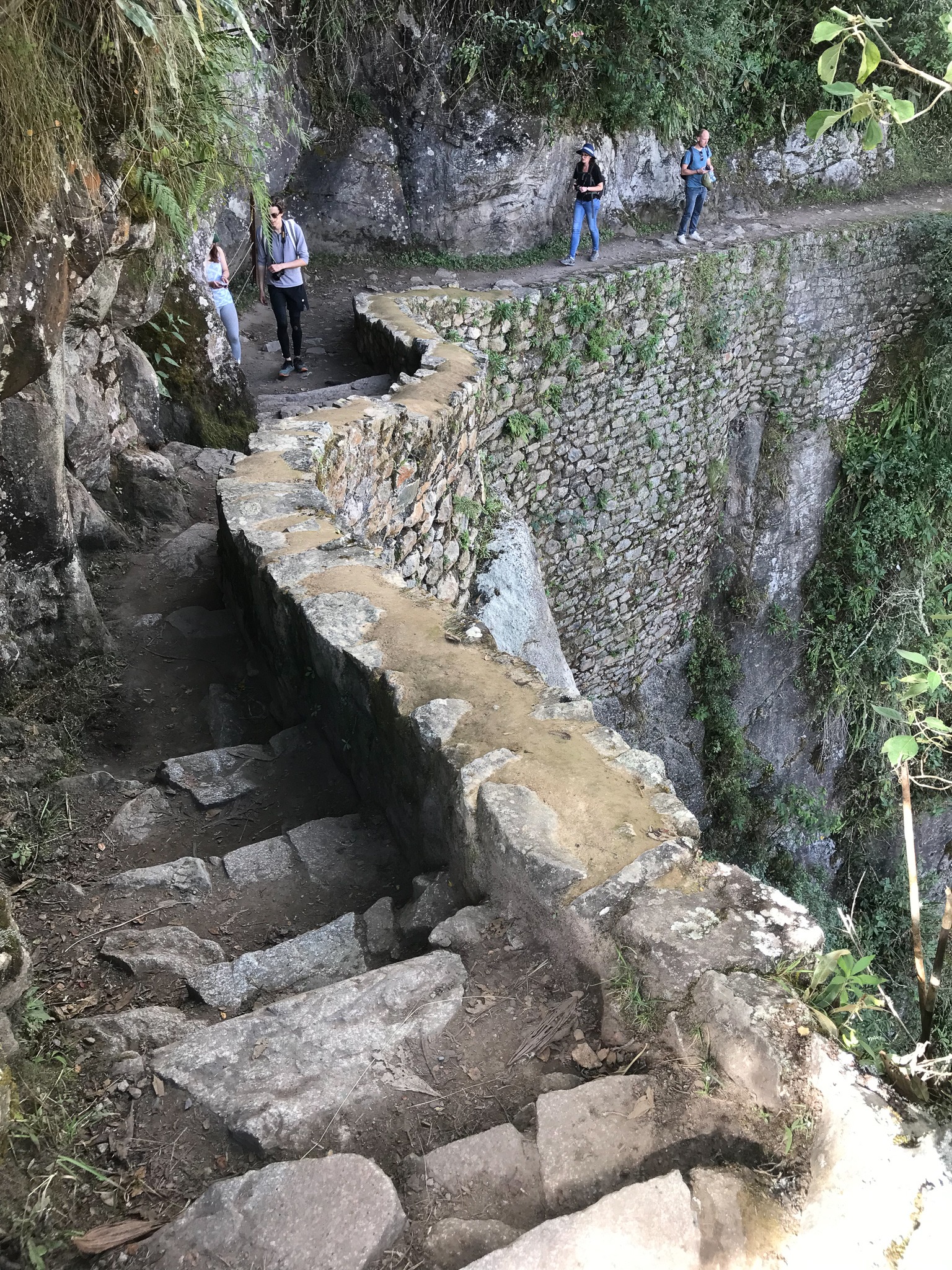
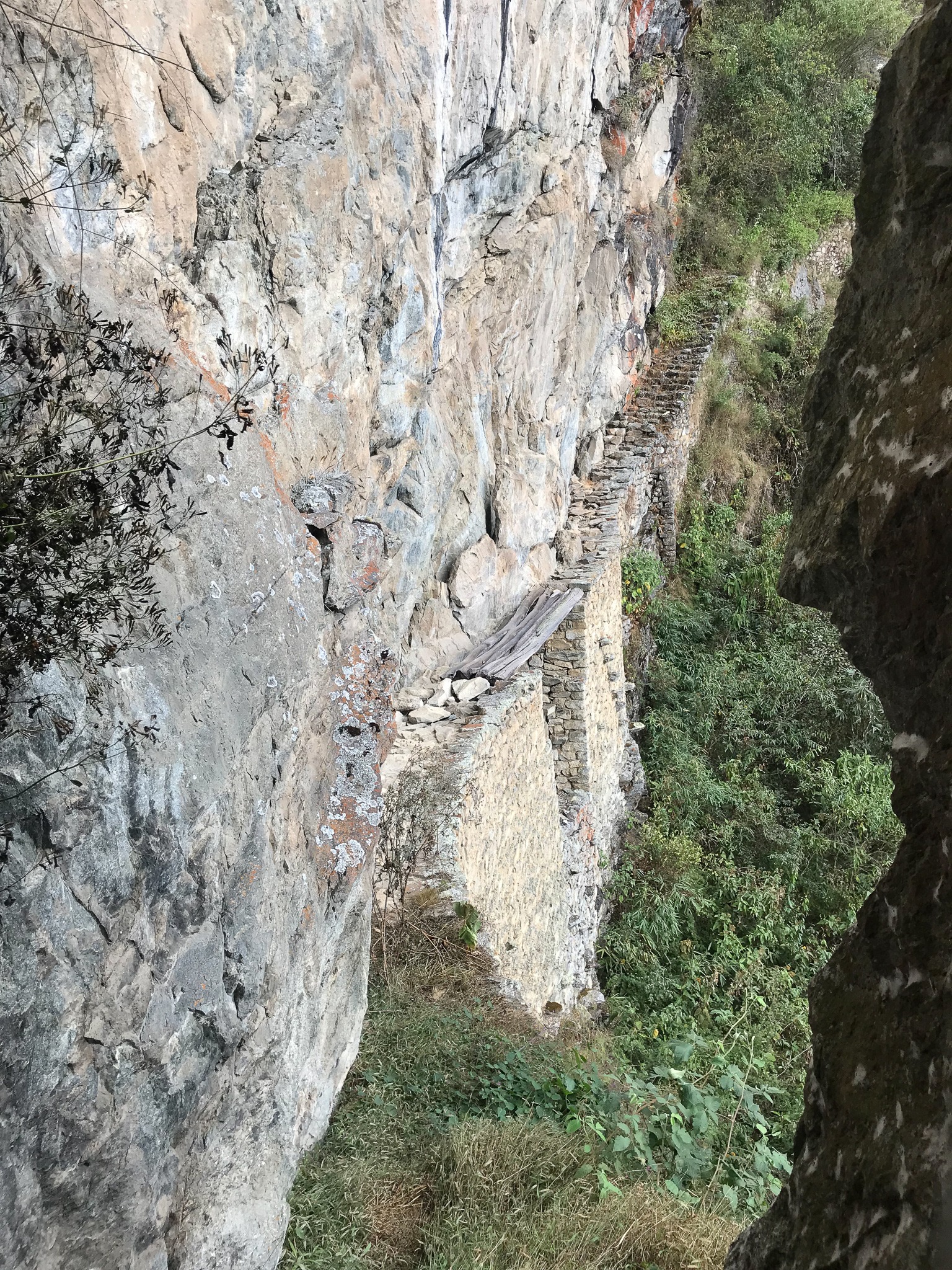
6) Puente Inka
Next, we walked to the Inca Bridge. (The word Inca/Inka seems to be spelled with the letters C and K used interchangeably.) The path to get there is carved out of the cliff rock. After about a one-kilometer walk (15-20 minutes), you can see a gap in the path, where a 20-foot drop to the ground below is covered by wood logs connecting the two, separated sections of the path. This is the Inca Bridge. It is believed that this bridge was made as a defense tool. The Inca people could remove the wooden logs in order to prevent the advance of any possible enemy along the path to the city.
7) Urubamba Valley
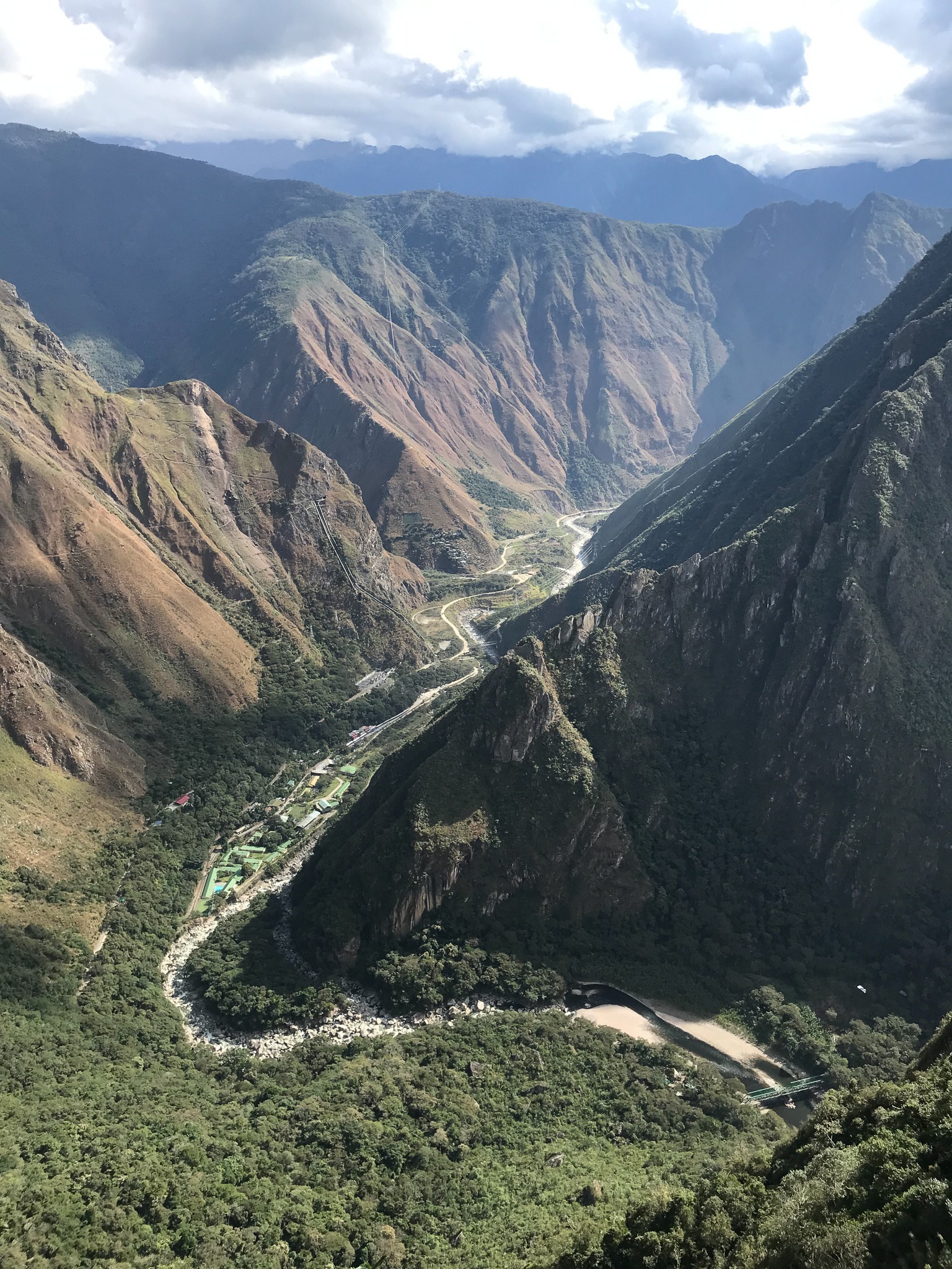
The Urubamba Valley, which you see in the picture below is the Sacred Valley of the Incas. The river running through it has four names: The Urubamba River, the Vilcanota River, the Willkanuta River (from the Aymara language), or Willkamayu River (from the Quechua language. (Aymara and Quechua are Native American languages.)
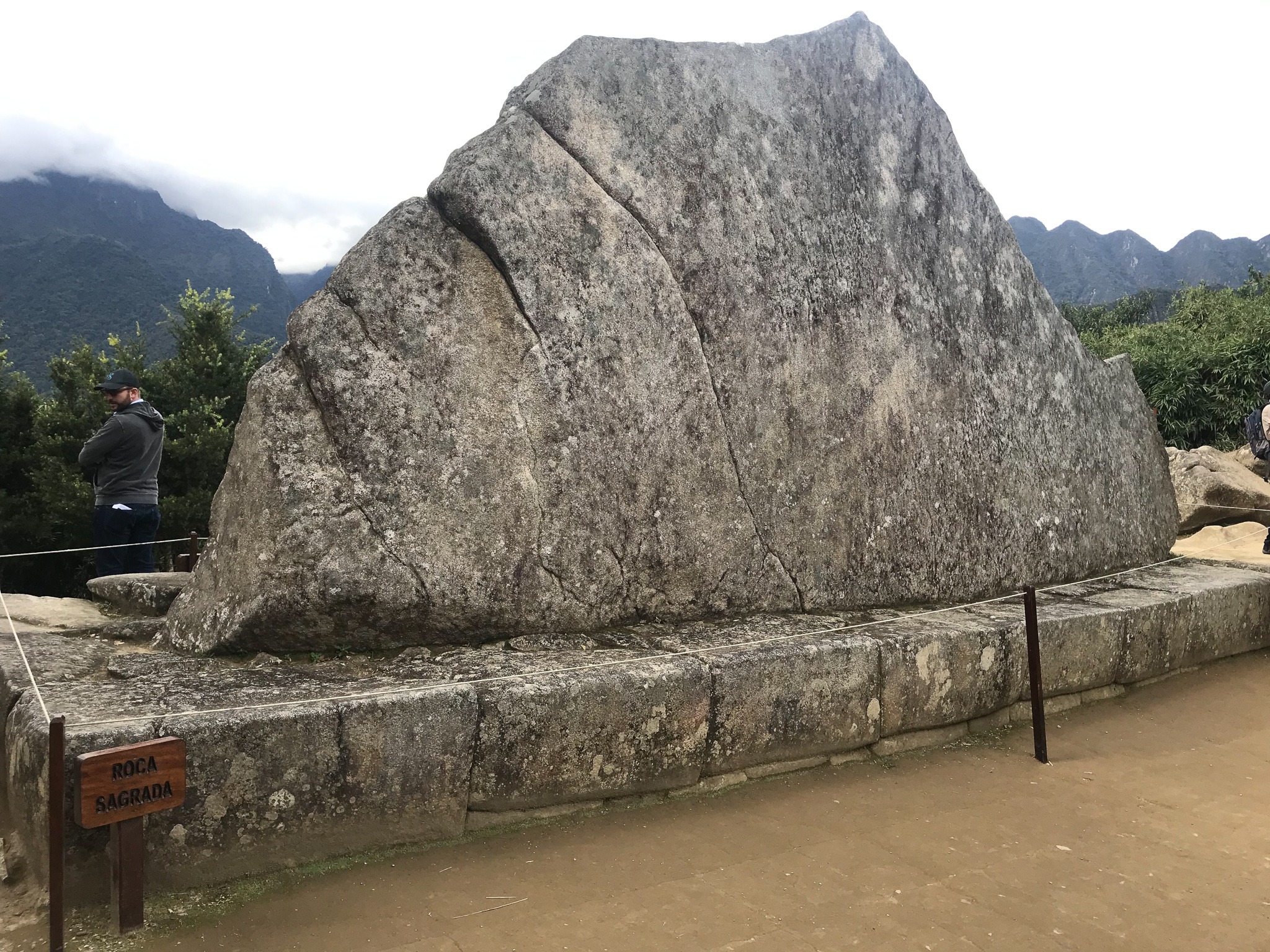
8) Sacred Rock
This Web page has a really nice explanation of the history behind and symbolism of the Sacred Rock: https://www.ticketmachupicchu.com/sacred-rock-machu-picchu/
9) House of the Guardian of Funerary Rock
Towards the top of the picture, you can see the house. This place has a fantastic view over the whole city. From here, the watchman would keep watch over Machu Picchu.
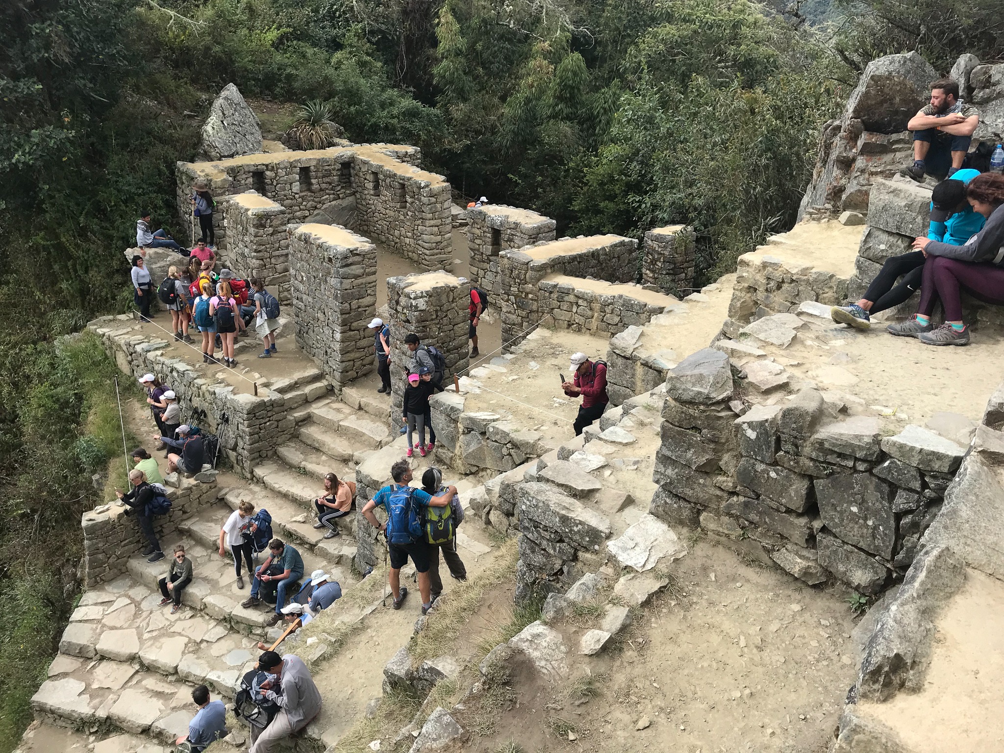
10) The City
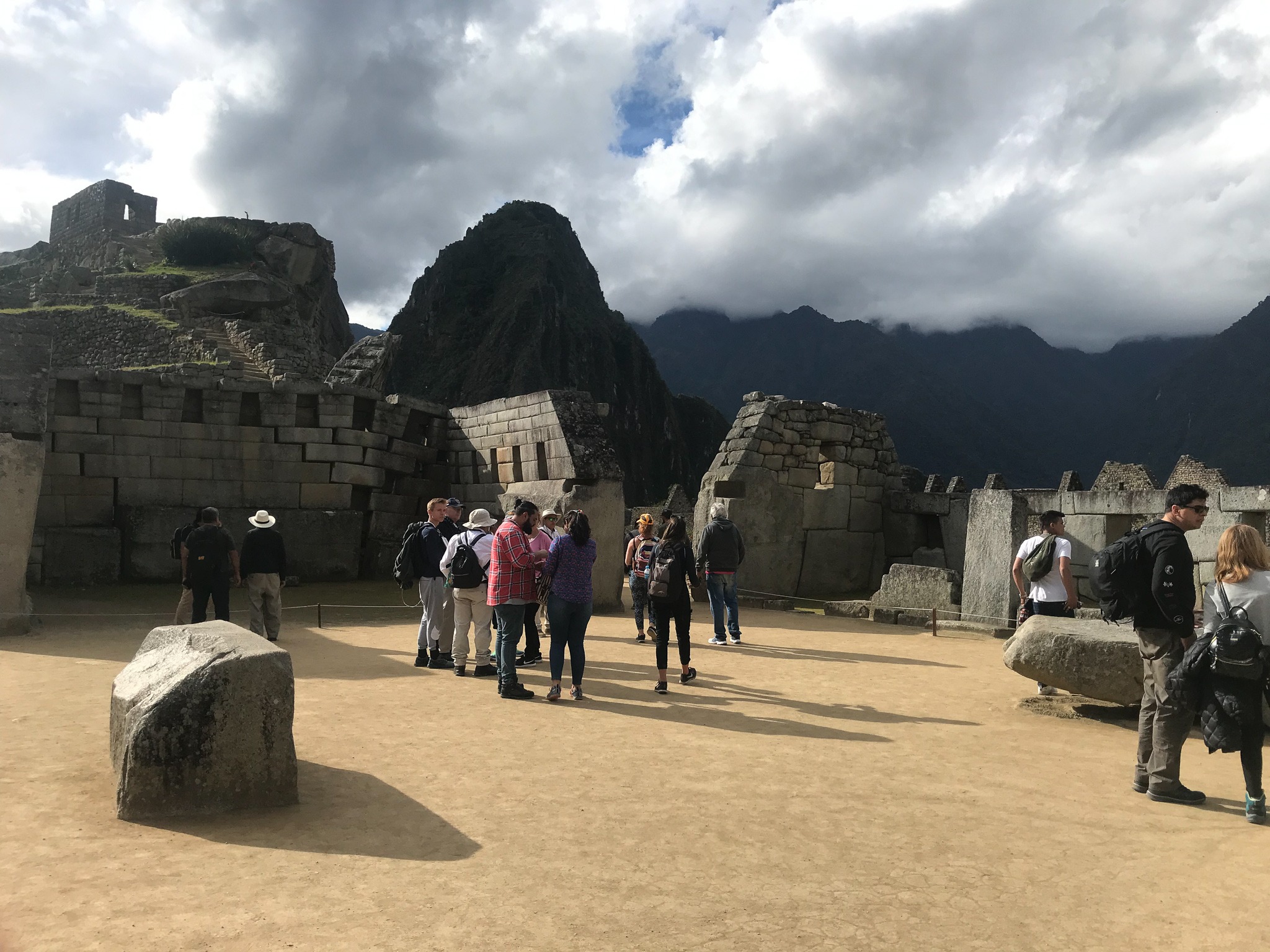
10a) Sacred Plaza
The Sacred Plaza was the political center of the city. You can read about it here: https://www.enjoy-machu-picchu.org/architecture/sacred-plaza.php
10b) House of the High Priest
Hiram Bingham suspected that this space (inside the rectangular room shown in the center of the picture below) was where the High Priest, the overseer of the citadel's temples, lived.
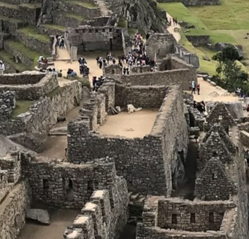
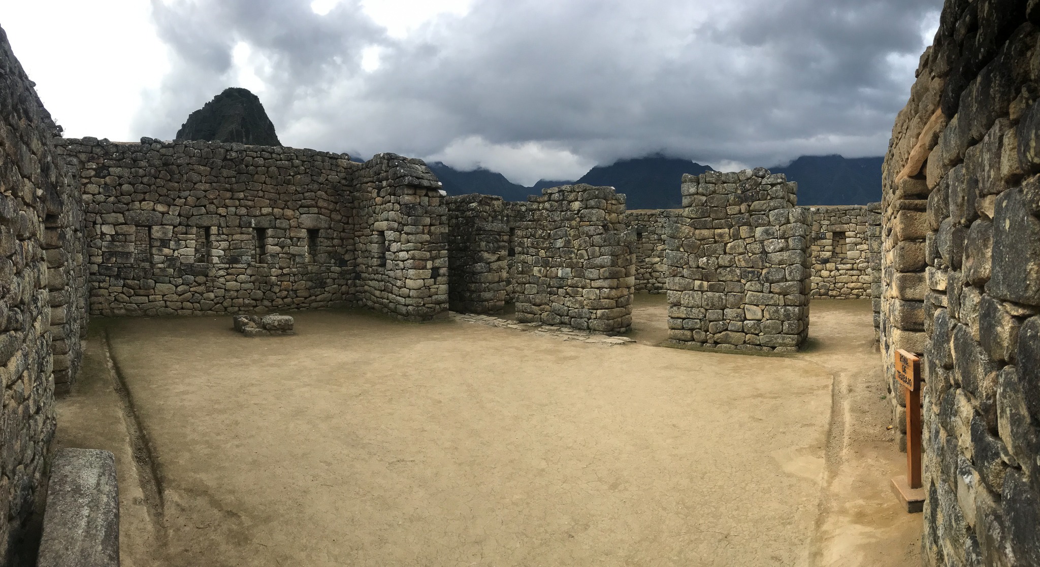
10c) Houses / Living Quarters
10d) Temple of the Sun & 10e) Terraces
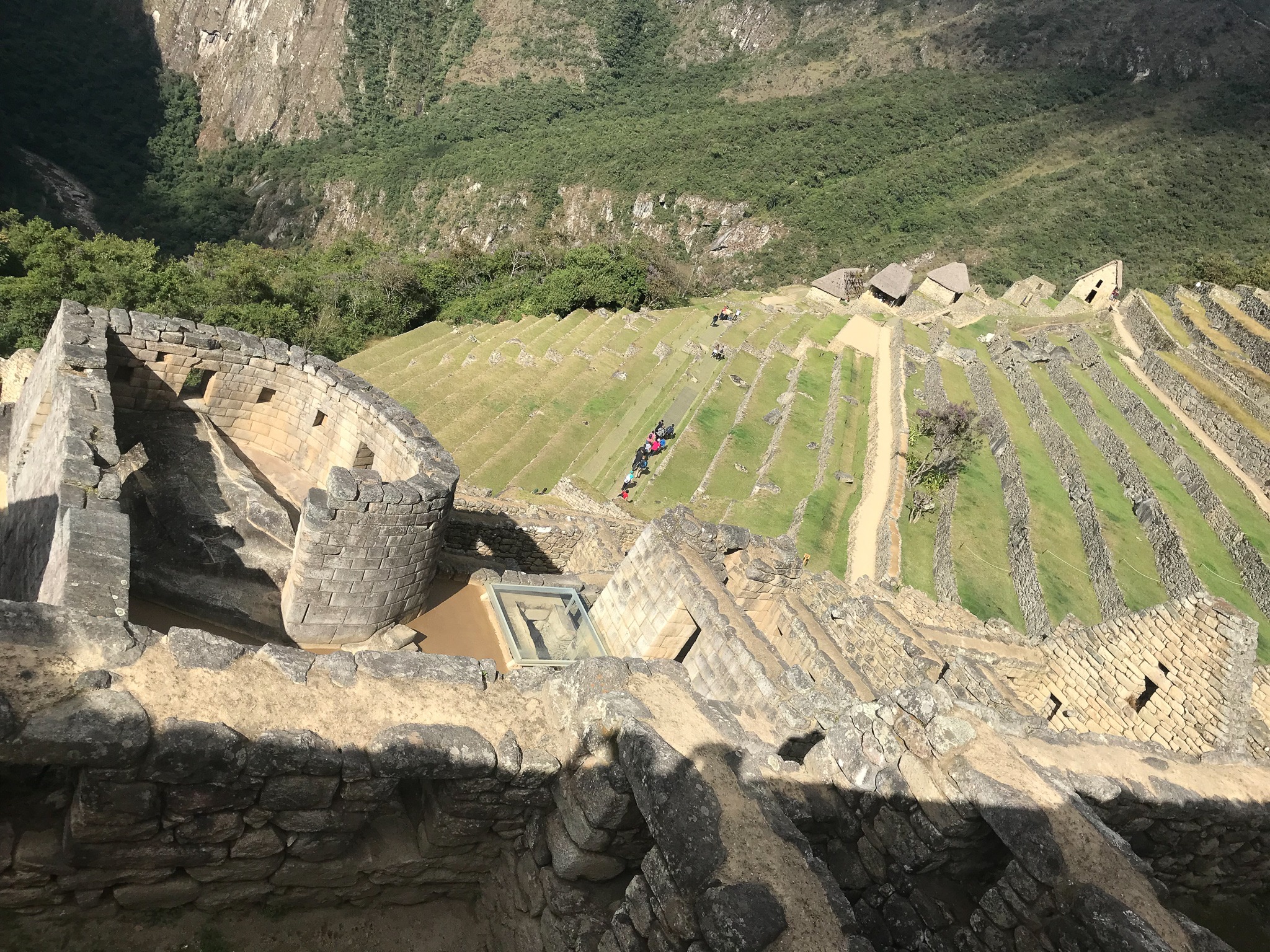
The "D" shaped room you see in the left side of the picture below is the Temple of the Sun. It was possibly used as an astronomical observatory. There are several niches in the temple where offerings would have been placed.
The terraces are the stair-like series of rows/levels that you can see in the picture above. The land of the hill on top of which the city lies is said to be designed like this in order to support the foundation of the city above.
I didn't learn this at Machu Picchu, but on a later trip to Moray, another Incan archaeological site in the Sacred Valley that has similar terraces, I learned that the Incas would strategically design and use these types of terraces for agricultural purposes. Our guide told us that each level of the terrace offered a different consistency of soil and a different level of exposure to weather conditions (rain and wind, for example), which meant that different crops would grow better on different terraces.
10f) Main/Central Plaza
The Main Plaza was a ceremonial gathering place. This Web page has a great description of it and what would happen here: https://www.enjoy-machu-picchu.org/architecture/main-plaza.php