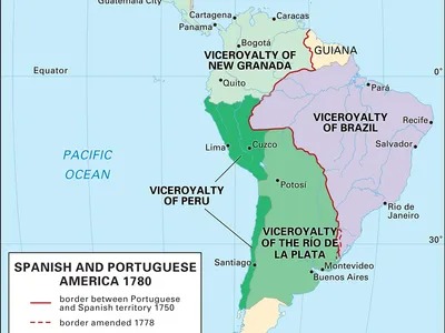
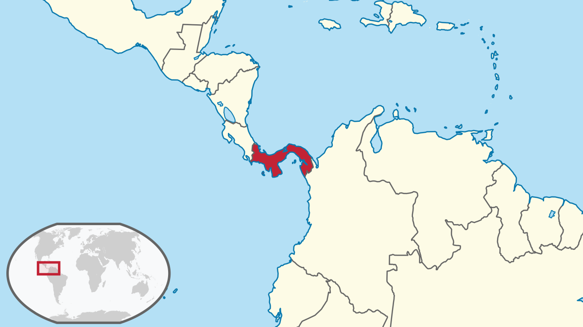
History Tour Through Casco Viejo, Panama City
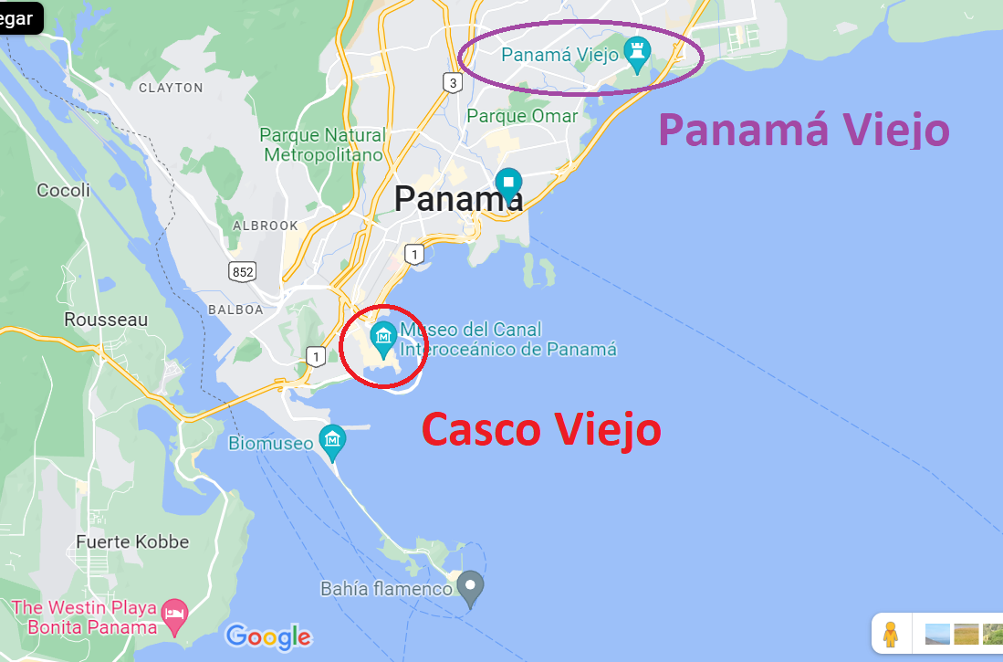
Panamá Viejo
There are two "old Panama City's." The first is Panamá Viejo, which was a settlement that was founded in 1519 by Spanish explorer Pedro Arias Dávila (de Ávila).
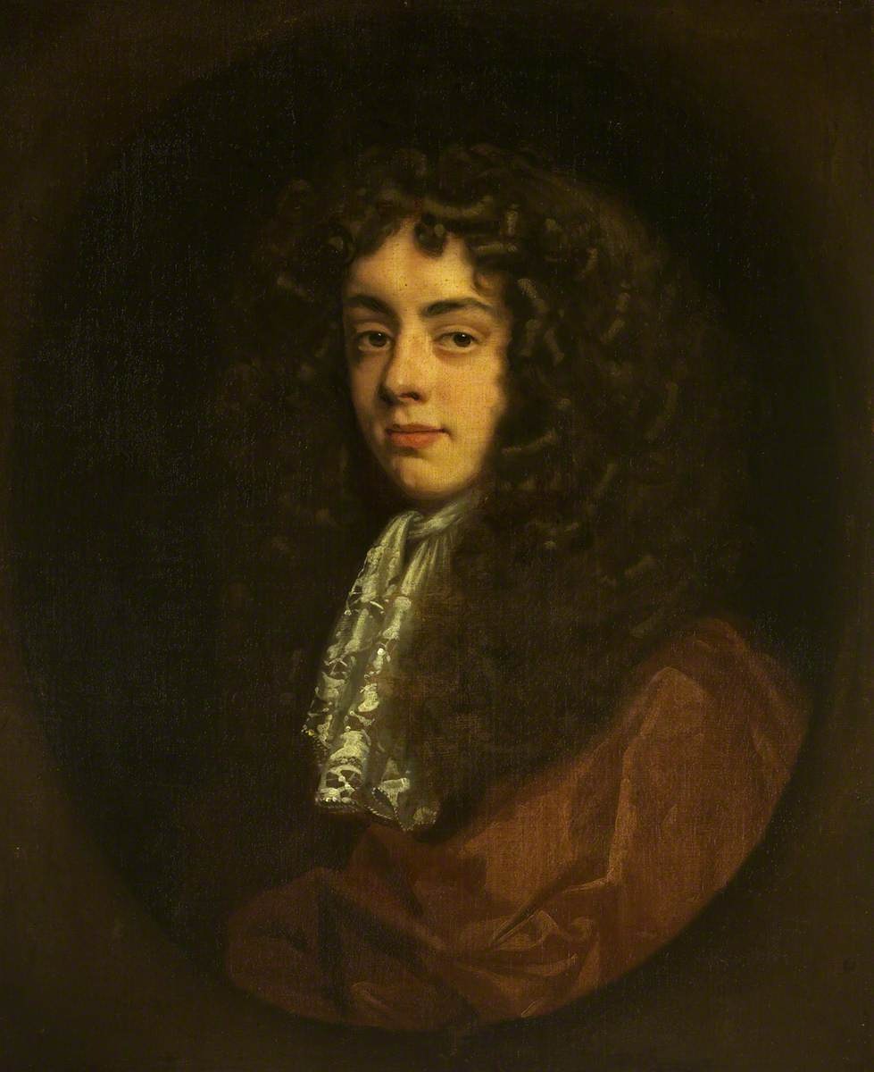
Henry Morgan
Panamá Viejo was destroyed in 1671 by Henry Morgan, a Welsh man who spent a significant chunk of his life in the Caribbean attacking and raiding Spanish settlements, running plantations, and three times acting as the Lieutenant Governor of Jamaica when the island was a British colony. The Internet calls Morgan a "privateer," but he certainly engaged in piracy.
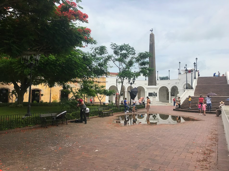
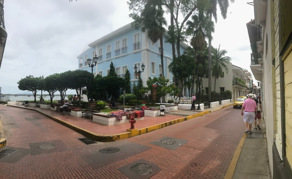
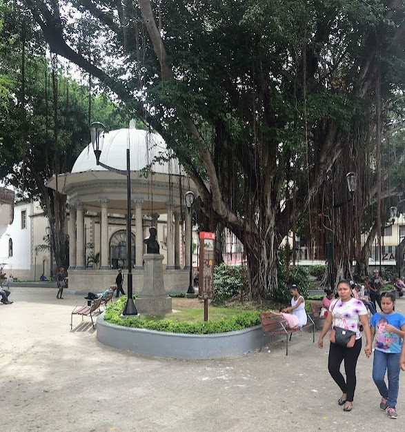
Casco Viejo
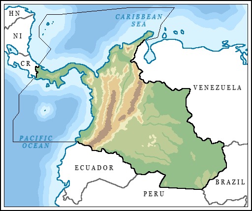
After Henry Morgan destroyed Panamá Viejo, Panama City was rebuilt eight kilometers south of its previous site starting in 1673. This new site has survived to this day. Of course, the city has expanded over the past three and a half centuries, but the original site, which is notable for its Spanish colonial architecture, is known today as Casco Viejo. Casco means "bit," or "fragment," so casco viejo is like "the old bit."
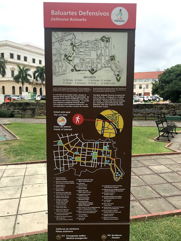
Site-markers
Now that we know why we are here (in Casco Viejo), the next thing to point out are the brown posts/signs that I called above "site-markers." You can give yourself a tour through Casco Viejo by visiting these site markers. They identify noteworthy sites in the village.
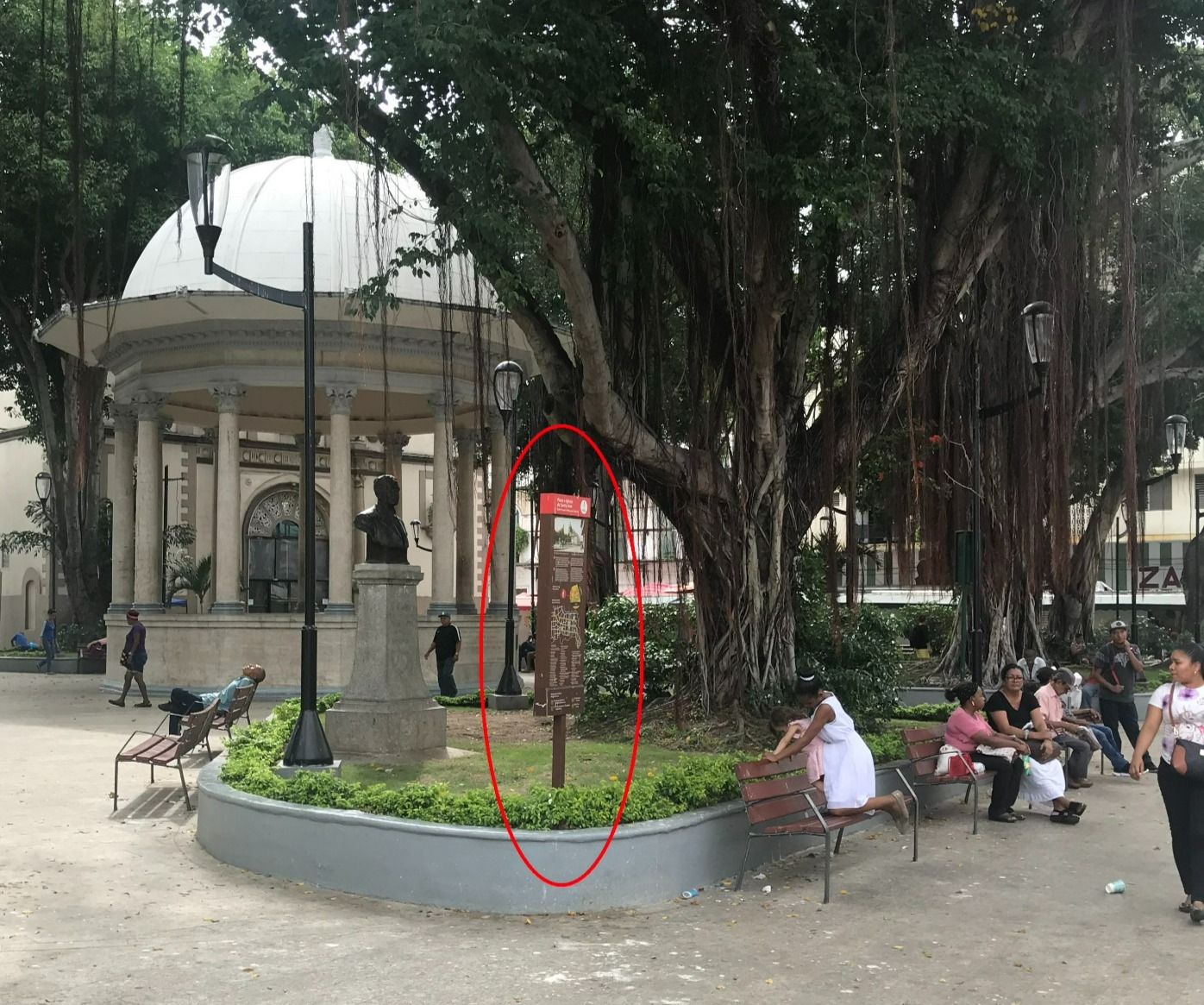
GPSmyCity Audio Tour
You can also download the GPSmyCity app on your phone and listen to an audio guide as you walk through Casco Viejo. Many of the landmarks on the audio tour align with the site-markers planted by Panama's Autoridad de Turismo.

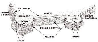
Baluartes / Bulwarks
After Henry Morgan destroyed Panamá Viejo, the "second Panama City" was built with a defense system. One of the main components of this defense system were "bulwarks," or baluartes in Spanish. A bulwark is a fortified stronghold--basically, a wall, or strategically shaped barrier--that not only aims to prevent entry by an outsider, but also has a variety of components within and on top of it to be strategically used by the defending army to defend itself and launch counter-attacks against attempting invaders. Here is a picture:
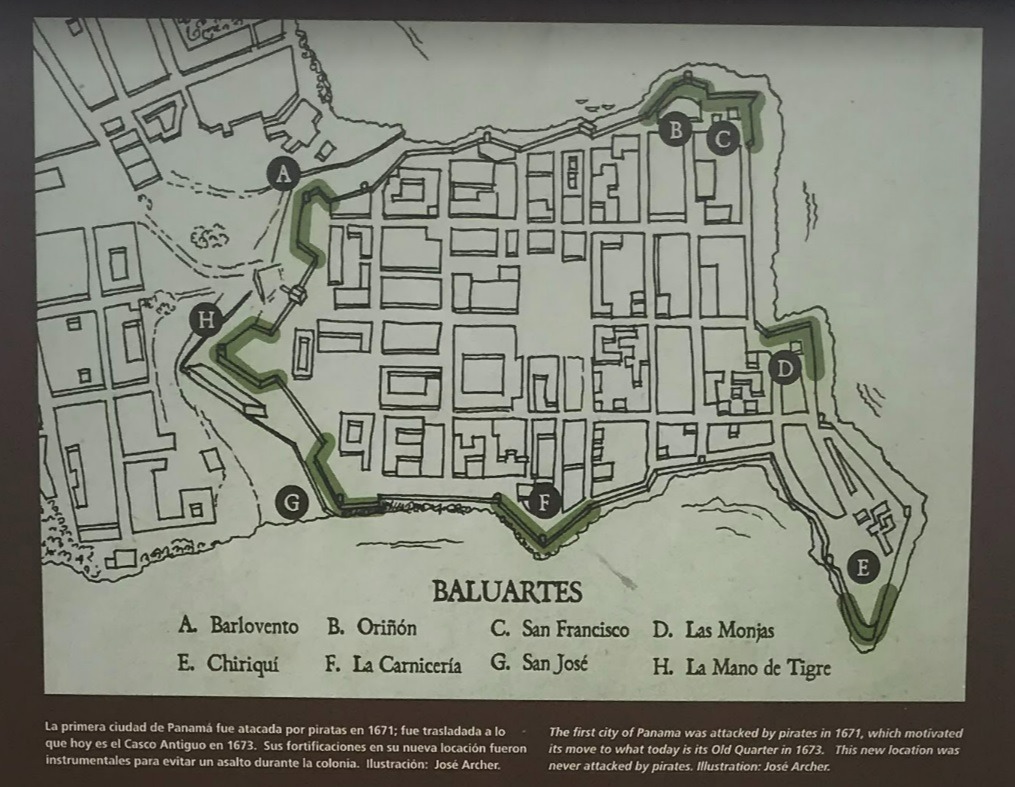
Baluarte de las Monjas / Nuns' Bulwarks
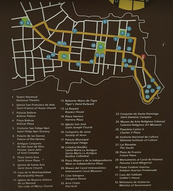
There are 32 site-markers in Casco Viejo. Some signs introduce you to a still existing landmark that you can tour. Others, like the one below, denote the site of something gone from the past.
The sign below marks the site of the Nuns' Bulwark. On the map shown in the second picture, the location is marked by letter D.
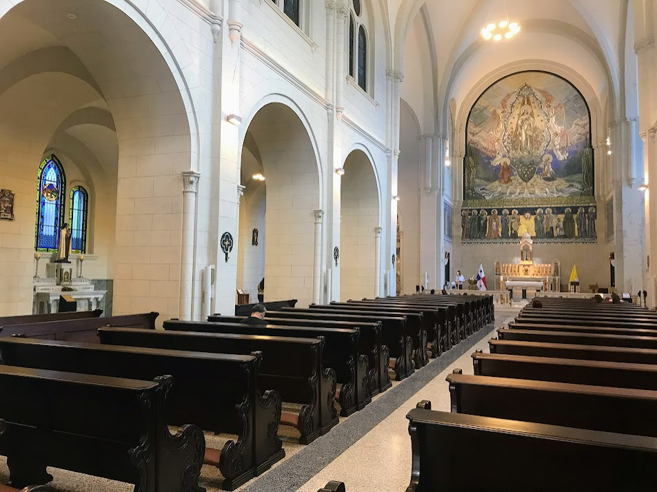
La Catedral de Panamá
The longer, official name of this cathedral is La Catedral Basílica Santa María la Antigua de Panamá. Construction of this Catholic church started in 1673, along with the construction of the "new Panama City."
Do you see the guy in the center of the picture below wearing jeans, gray t-shirt, and gray hat? He decided that he would be my tour guide. There are local guys who will hang out in Casco Viejo and, for lack of a better word, impose themselves on tourists as self-designated "tour guides." They are just looking to make themselves some money. I went along with it for 30 minutes or so. His information was actually really good. He was speaking in English, which is known by a decent amount of Panamanians (14%)--not only business professionals, but people who are of families who came from English speaking Caribbean islands like Jamaica and Barbados to work on construction of the Panama Canal in the early 1900's. I researched a lot of what he told me and it seemed to align with what I read at the sites in Casco Viejo and on the Internet. Eventually, though, I wanted to just do the tour by myself, so I gave the man a few dollars and he knew that it meant I was ready to be left alone.
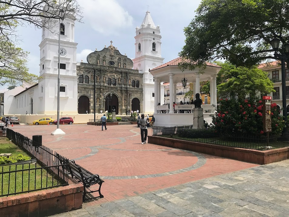
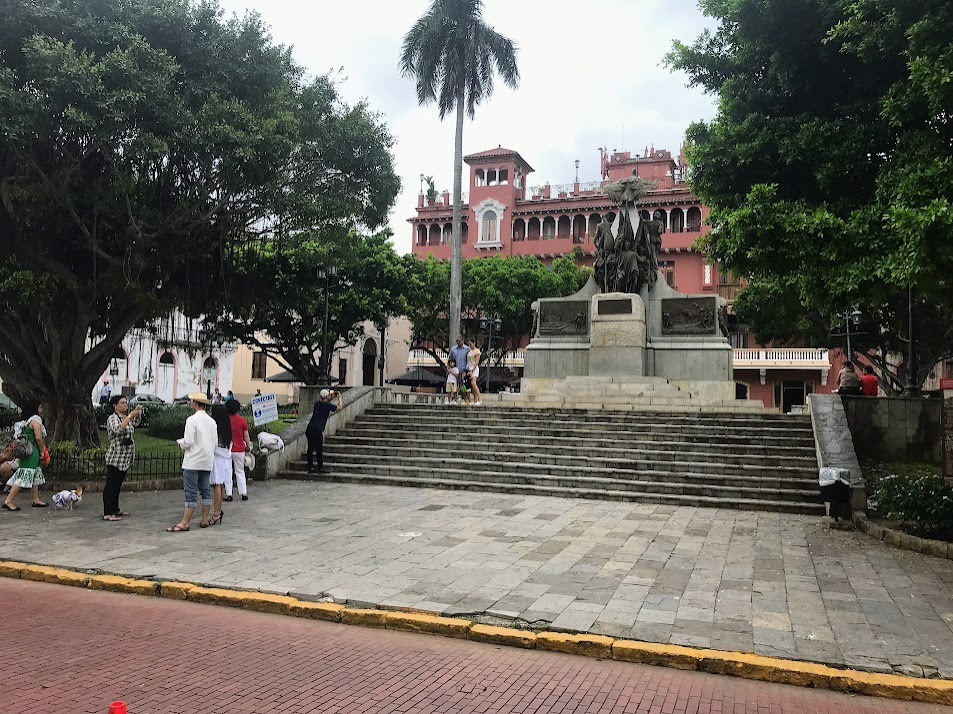
Plaza de la Independencia
This is the name of the plaza in front of the cathedral in the picture above. The territory of the country now known as Panama has been through several independence movements over the past few centuries, as I will write about later on, but the name of this plaza is for Panama's independence from Colombia in 1903.
Source: https://www.gpsmycity.com/attractions/plaza-de-la-independencia-(independence-square)-33472.html
Timeline: https://www.historyfiles.co.uk/KingListsAmericas/CentralPanama.htm
Iglesia de San Francisco de Asís
This Catholic church was built in the early 1700's with the help of indigenous artisans and Franciscan monks.
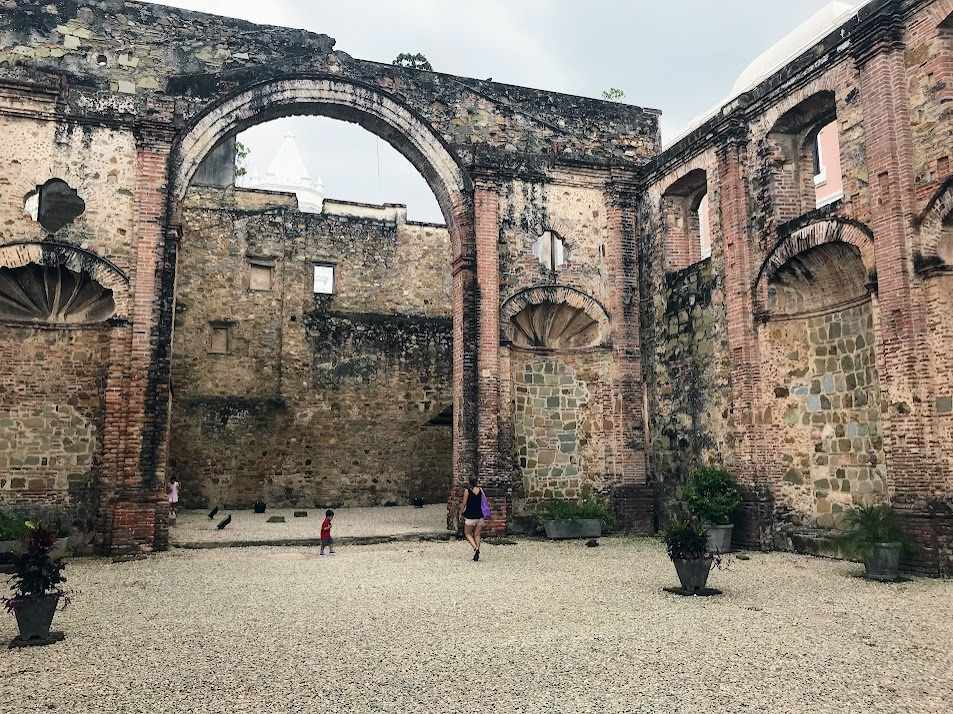
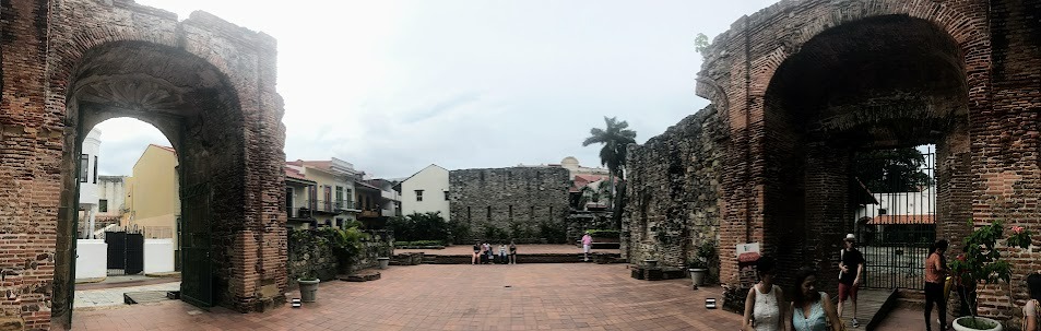
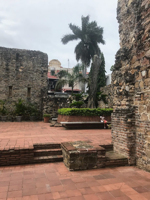
Iglesia de la Compañía de Jesús
These are the ruins of a Jesuit temple and convent. The Jesuits, or Society of Jesus, are an order of religious men founded by St. Ignatius of Loyola known for educational, missionary, and charitable works.
In 1749, a Royal Decree granted the Jesuits license to found three professorships (philosophy, moral theology, and scholasticism) at the College of the Society of Jesus in Panama. After that, construction of this building began. Eventually, the entire block was occupied by the Jesuits. Here, they also built La Real y Pontificia Universidad de San Javier, which was the first university on the isthmus of Panama.
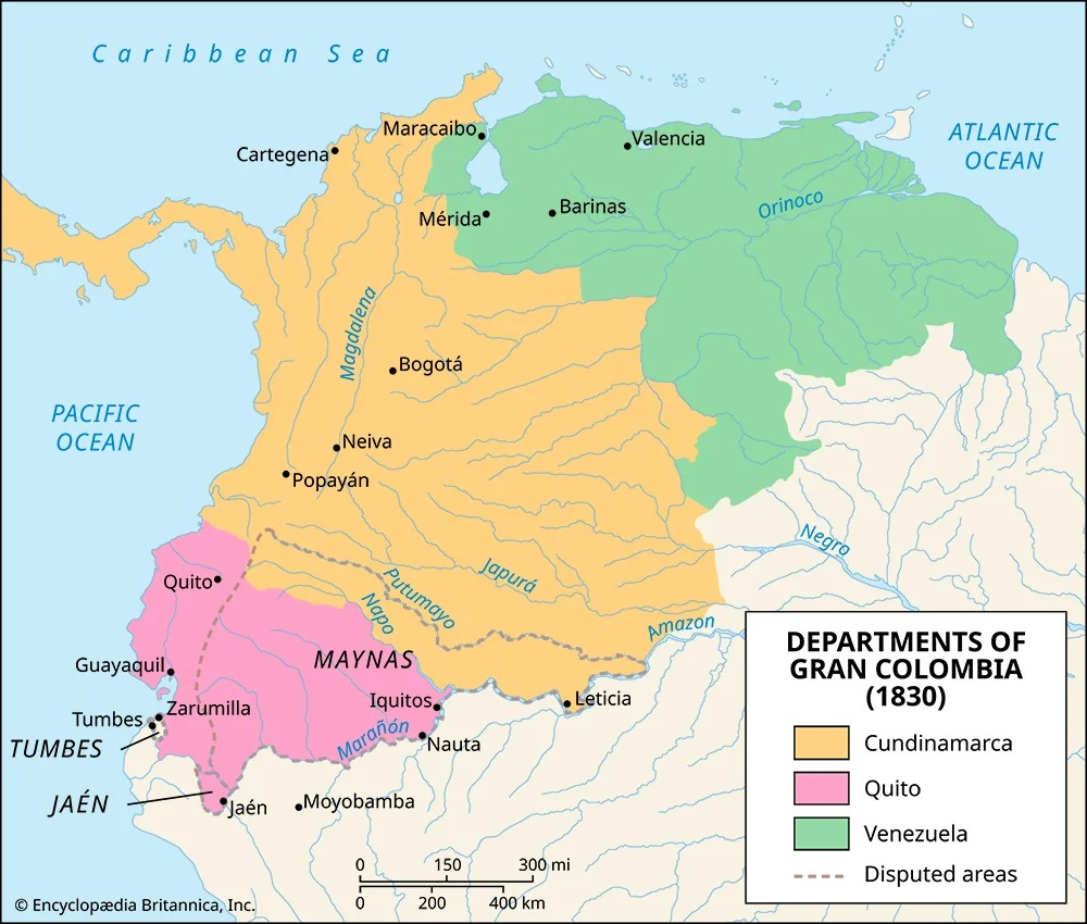
In 1767, however, King Carlos III of Spain signed orders to expel the Jesuits from all Spanish lands, which included Panama, as at this point the isthmus was part of the Spanish Viceroyalty of New Granada, an administrative territory that encompassed several modern day countries in northwestern South America plus Panama. During the late 1700's, many Western European governments banned the Jesuits from their lands out of fear of the amount of power and influence that they seemed to be amassing through their close relationships with the pope of the Catholic Church.
Construction of this church here in Casco Viejo was likely never completed. It was further destroyed by an earthquake.
Source: https://panamacascoviejo.com/society-of-jesus-jesuits-panama/
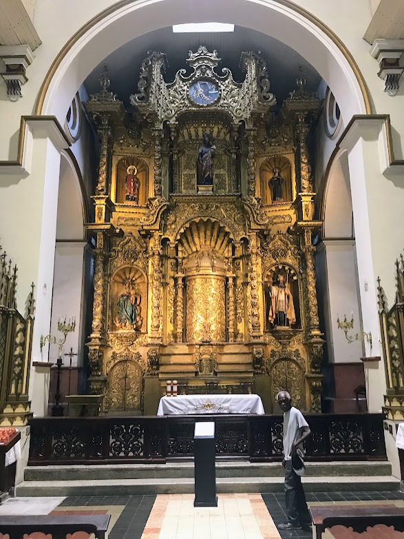
Iglesia de San José: El Altar de Oro
The gold altar in this church is the main attraction. There is a legend about it. Remember Henry Morgan? The legend says that as he was coming to Panama, a friar, who had heard of Morgan's impending arrival and knew of the Welshman's reputation for theft, removed the gold from the altar and hid it by submerging it in the ocean water nearby. The legend continues that Morgan was so amused by the friar's attempt and explanation that the altar was under construction, as well as request for money to finish the project, that he called the friar "more of a pirate than me," laughed, and gave him the requested money. However, all that said, according to the displays in the church, historians believe that the fact that the altar's style matches with a style of 18th century architecture, while Morgan's raid took place in 1671, shows that the legend cannot be true.
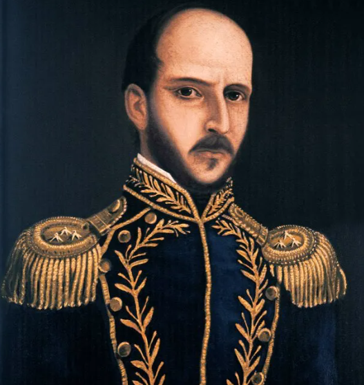
Plaza Simón Bolívar
Below you see a plaza and monument devoted to Simón Bolívar, one of the most important people in the modern history of the Americas. He is of legendary status to many people in the countries of north-northwestern South America, kind of like George Washington is to the United States. Bolívar helped liberate the countries we currently know as Colombia, Venezuela, Ecuador, Peru, Panama, and Bolivia from the Spanish Empire between 1819 and 1825.
Timeline (1819 - 1831)
It can be difficult to process all of the developments in Panamanian history during this time, so here is a timeline to help you do so:
Before 1819: Viceroyalty of New Granada
Before 1819, the isthmus of Panama belonged to the Viceroyalty of New Granada, an administrative territory of the Spanish Empire.
1819: The Battle of Boyacá
This battle concludes with the Spanish Royalist Army surrendering to Simón Bolívar. New Granada is liberated.
1819: Gran Colombia
The territory formerly known as Viceroyalty of New Granada under the Spanish Empire declares itself an independent country under the name of Gran Colombia.
1819-1831: During this time, there are disagreements among factions within the ruling classes of this newly established country.
1819-1831
Gran Colombia is dissolved as three new countries declare themselves: Venezuela, Ecuador, and New Granada. The Republic of New Granada consisted mainly of the lands of present-day Colombia and Panama plus small portions of other surrounding countries.
Plaza Herrera
This plaza and the monument within it is devoted to Tomás Herrera, a New Granadian (neogranadino) politician and military leader.
Timeline continued... (1840-1903)
1840-41: Estado del Istmo
The "State of the Isthmus" was the "first independent Panama." The isthmus of Panama seceded from New Granada in 1840 for 14 months only to rejoin peacefully at the end of 1841. The republic's one and only president was Tomás Herrera.
1858: Confederación Granadina
New Granada changes its name to the Granadine Confederation.
1863: Estados Unidos de Colombia
After the Colombian Civil War of 1860-62, the United States of Colombia was created in 1863. The country still included the isthmus of Panama.
1886: La República de Colombia
After several years of intermittent civil wars, in 1886, the Colombian Conservative Party led by President Rafael Núñez proclaimed a new, more "centralist" constitution, thus abolishing the United States of Colombia and declaring the Republic of Colombia. This is the official name of Colombia still today.
1903: Independence of Panama
With the backing of the United States, which was aiming to build the Panama Canal here, Panama gains its independence from Colombia.
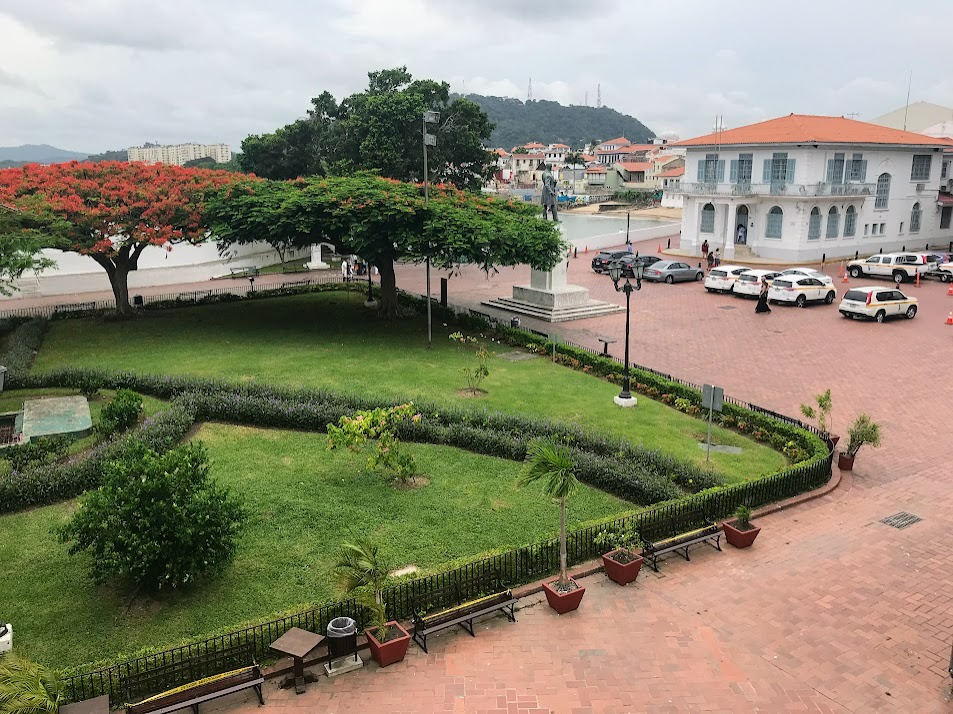
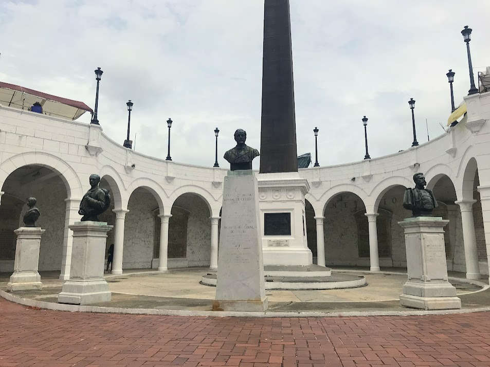
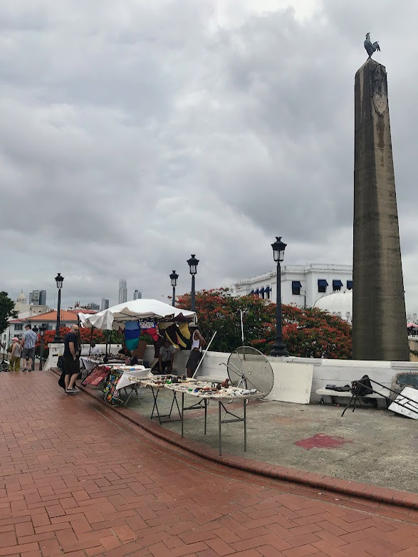
Plaza de Francia
At this point (late 1800's), the next major development in Panama's history is the construction of the Panama Canal. This plaza here is devoted to France, the country who attempted, albeit unsuccessfully, to build the Panama Canal in the late 1800's.
The plaza was initially known as the Plaza of Chiriquí. Chiriquí is a word that you can encounter throughout Panama. It's the name of a province, a lake, a football club, and more. It means "valley of the moon" in the language of the Ngobe-Buglé indigenous people.
Las Bóvedas
Remember the bulwarks that were a major feature of the defense system of the "second Panama City?" Here, in the Plaza of France, there a bulwarks that were called Baluartes de Chiriquí. However, this structure has become known for its bóvedas, which were like storage cupboards inside the arched ceilings that you can see on top of each pillar inside of the bulwarks.
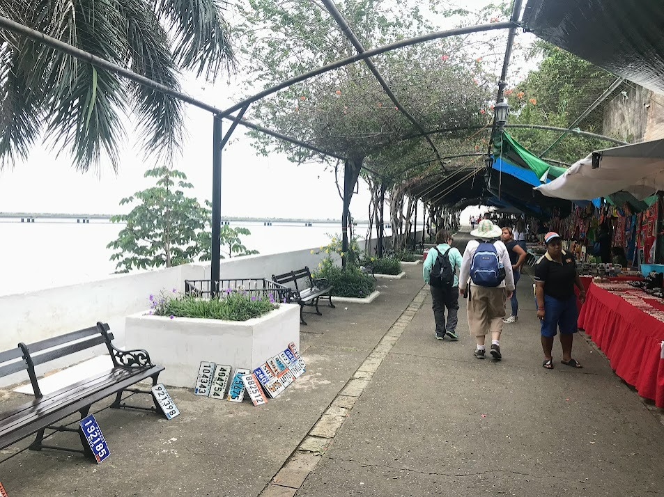
Paseo de las Bóvedas
This is the walking path that runs along the top of the Chiriquí Bulwarks.
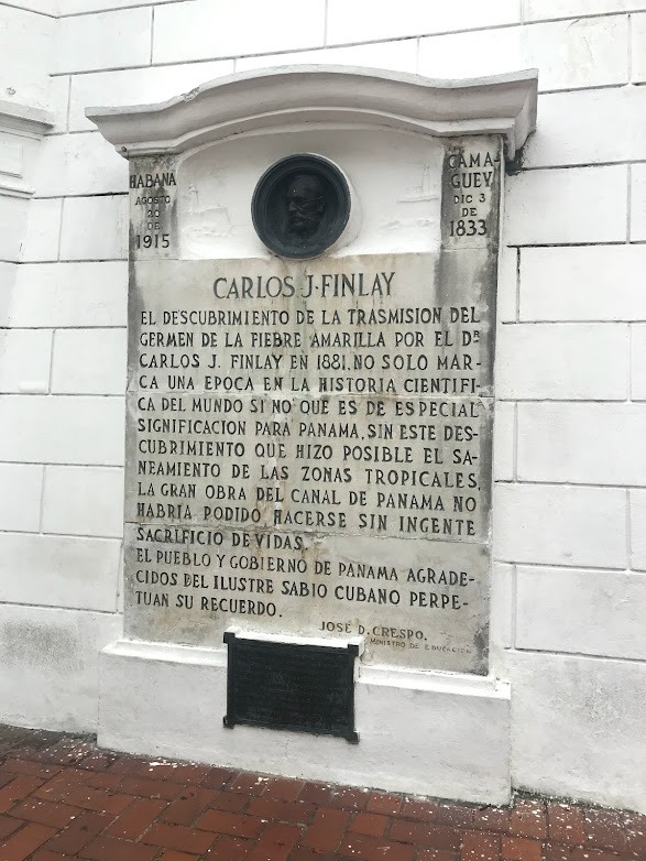
Carlos Finlay
Carlos Finlay is honored at this plaza. He is the man who discovered that Yellow Fever, the disease that is credited with being the main one to decimate indigenous populations throughout the Americas after European arrival, was transmitted by mosquitoes (1881). He was Cuban.
Plaza Emperador Carlos V
This southeast corner of Casco Viejo is themed by the Panama Canal history. Right next to the Plaza of France is this plaza dedicated to Carlos V, the Spanish king who was the first person to come up with the idea of the Panama Canal. He recognized how valuable the isthmus of Panama was as a potential connector of the Atlantic and Pacific Oceans.
Arco Chato
Also related to the Panama Canal is Arco Chato, which is the site of ruins of an ancient monastery. Yes, the ruins are of a building that was from the colonial era, but they are relevant to the canal because legend says that when discussing whether or not Panama could be a good site for an interoceanic canal, planners "said that if the Arco Chato could withstand the region's earthquakes, then a canal sure could, too."
Gentrification in San Felipe
Gentrification has been a contentious topic over the past decade in my hometown of Pittsburgh. It seems that the debate about it clearly exists in other parts of the world, too.
This sign in the picture below says, "The country is being sold to the highest bidder."
By the way, the sign refers to Casco Viejo as San Felipe, which is the official name of the area. San Felipe is a "corregimiento," or administrative area within the larger District of Panama. Just like in the United States, within our country, we have multiple layers of government administration (state > county > city > district), Panama has their own structure and titles: Country > province > district > corregimiento.
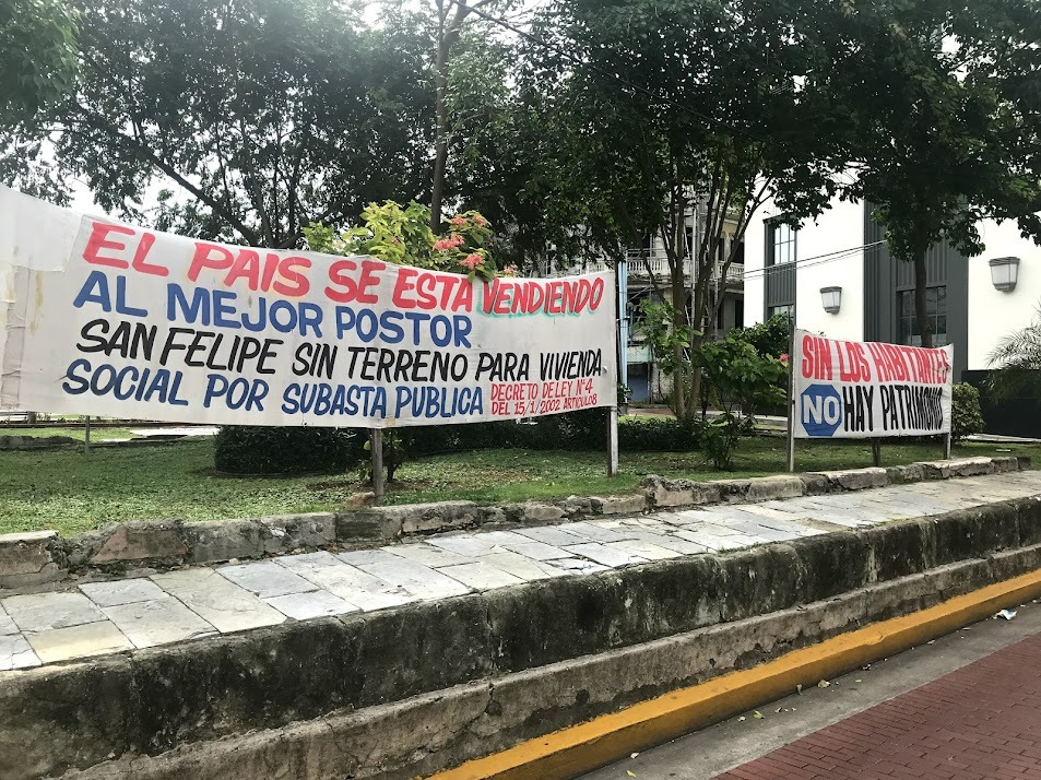
Corregimiento
This word comes from the Spanish imperial times. A corregimiento was a designated area managed by a corregidor, which means "corrector" in English, who would help assure that all people and operations in the territory were loyal to and controlled by the Spanish crown, rather than local elites.
Plaza Santa Ana
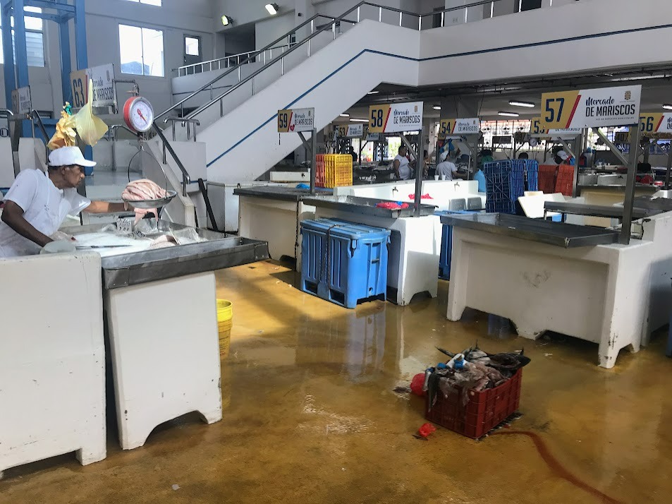
Mercado de Mariscos
Casco Viejo is right on the water, so it makes sense that there is a fish market...
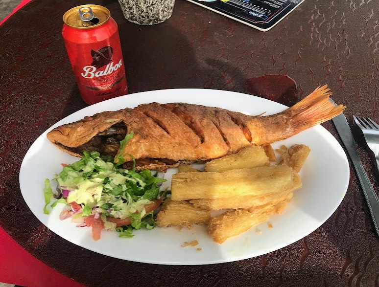
Don Pescado Panamá
At this point I was pretty hungry, so I concluded my self-guided history tour of Casco Viejo and go lunch at this restaurant--Fish, salad, and yuca fries with Balboa, "the first beer of [Panama]," (according to their can).
Post a comment